Herlen geodata
Herlen (Hentiy) is a seat of a second-order administrative division; located in Mongolia in Asia/Ulaanbaatar (GMT+8) time zone. In our database, there are 33 cities with bigger population. Compared to other cities in Mongolia, 56.7% of cities are located further ↑North; 88% of cities are located further ←West and 81% of cities have higher elevation than Herlen. Note1


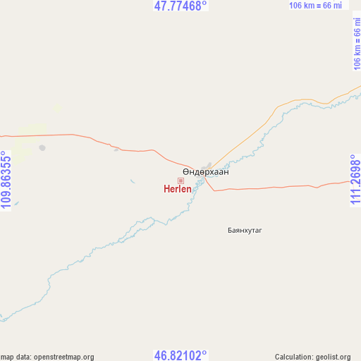
Herlen GPS coordinates[2]
47° 18' 0" North, 110° 34' 0.012" East
| Map corner | latitude | longitude |
|---|---|---|
| Upper-left | 47.77468°, | 109.86355° |
| Center: | 47.3°, | 110.56667° |
| Lower-right: | 46.82102°, | 111.2698° |
| Map W x H: | 106×106 km | = 65.9×65.9mi |
| max Lat: | 51.50725° ⇑56.7% North |
| Herlen: | 47.3° |
| min Lat: | ⇓43.3% South 42.84199° |
| min Long | Herlen | max Long |
| 89.14358° | 110.56667° | 118.51014° |
| W 88%⇐ | ⇒12% E |
Elevation
Elevation of Herlen is 1046 m = 3432 ft, and this is 370.5 m = 1216 ft below average elevation for this country.
| Max E: |
2800 m = 9186 ft | 81% |
| Avg. | 1416.5 m = 4647 ft | |
| Herlen | 1046 m = 3432 ft | |
Min E: |
619 m = 2031 ft | 19% |
See also: Mongolia elevation on elevation.city.
Geographical zone
Herlen is located in North temperate zone (between Tropic of Cancer and the Arctic Circle). Distance of this North polar circle is 2141.9 km =1330.9 mi to North.| Distance of | km | miles | from Herlen |
|---|---|---|---|
| North Pole | 4747.8 | 2950.1 | to North |
| Arctic Circle | 2141.9 | 1330.9 | to North |
| Tropic Cancer | 2653.3 | 1648.7 | to South |
| Equator | 5259.3 | 3268 | to South |


Nearby cities:
15 places around Herlen: (largest is in red/bold)
• Avraga
104.8 km =65.1 mi,  262°
262°
• Bayan
24 km =14.9 mi,  128°
128°
• Bayan
120.7 km =75 mi,  194°
194°
• Bayan
144.2 km =89.6 mi,  15°
15°
• Bayanbulag
79.7 km =49.5 mi,  322°
322°
• Bayasgalant
117.6 km =73.1 mi,  107°
107°
• Buyant
118.5 km =73.6 mi,  170°
170°
• Darhan
115.7 km =71.9 mi,  228°
228°
• Dundbürd
100.1 km =62.2 mi,  44°
44°
• Hanhöhiy
122.9 km =76.4 mi,  73°
73°
• Javhlant
128.2 km =79.7 mi, 65°
• Modot
124.4 km =77.3 mi,  293°
293°
• Mörön
21 km =13 mi,  295°
295°
• Ulaan-Ereg
76.2 km =47.3 mi, 234°
• Undurkhaan
7 km =4.3 mi, 72°
Sources, notices
• [Note1] Compared only with cities in Mongolia existing in our database
• [Src1] Map data: © OpenStreetMap contributors (CC-BY-SA)
• [Src2] Other city data from geonames.org with taken over terms of usage.
• [Src3] Geographical zone / Annual Mean Temperature by Robert A. Rohde @ Wikipedia
