Enhtal geodata
Enhtal (Selenge) is a seat of a second-order administrative division; located in Mongolia in Asia/Ulaanbaatar (GMT+8) time zone. In our database, there are 33 cities with bigger population. Compared to other cities in Mongolia, 82.2% of cities are located further ↓South; 65.3% of cities are located further ←West and 96.3% of cities have higher elevation than Enhtal. Note1


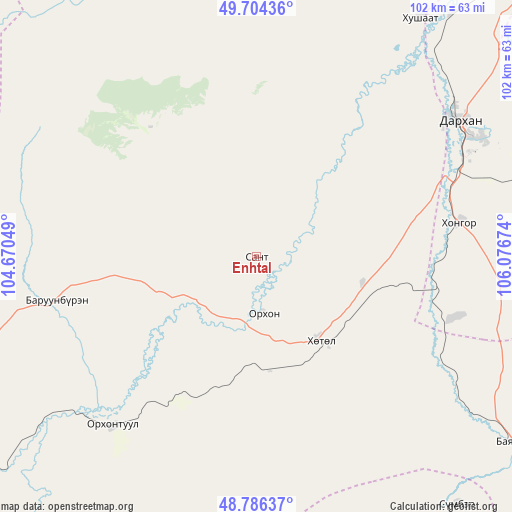
Enhtal GPS coordinates[2]
49° 14' 51" North, 105° 22' 24.996" East
| Map corner | latitude | longitude |
|---|---|---|
| Upper-left | 49.70436°, | 104.67049° |
| Center: | 49.2475°, | 105.37361° |
| Lower-right: | 48.78637°, | 106.07674° |
| Map W x H: | 102.1×102.1 km | = 63.4×63.4mi |
| max Lat: | 51.50725° ⇑17.8% North |
| Enhtal: | 49.2475° |
| min Lat: | ⇓82.2% South 42.84199° |
| min Long | Enhtal | max Long |
| 89.14358° | 105.37361° | 118.51014° |
| W 65.3%⇐ | ⇒34.7% E |
Elevation
Elevation of Enhtal is 741 m = 2431 ft, and this is 675.5 m = 2216 ft below average elevation for this country.
| Max E: |
2800 m = 9186 ft | 96.3% |
| Avg. | 1416.5 m = 4647 ft | |
| Enhtal | 741 m = 2431 ft | |
Min E: |
619 m = 2031 ft | 3.7% |
See also: Mongolia elevation on elevation.city.
Geographical zone
Enhtal is located in North temperate zone (between Tropic of Cancer and the Arctic Circle). Distance of this North polar circle is 1925.4 km =1196.4 mi to North.| Distance of | km | miles | from Enhtal |
|---|---|---|---|
| North Pole | 4531.3 | 2815.6 | to North |
| Arctic Circle | 1925.4 | 1196.4 | to North |
| Tropic Cancer | 2869.9 | 1783.3 | to South |
| Equator | 5475.8 | 3402.5 | to South |


Nearby cities:
15 places around Enhtal: (largest is in red/bold)
• Burgaltay
45.8 km =28.5 mi,  272°
272°
• Darhan
47.8 km =29.7 mi,  56°
56°
• Dzüünharaa
90.4 km =56.2 mi,  119°
119°
• Hongor
38 km =23.6 mi,  92°
92°
• Hushaat
33.1 km =20.6 mi,  32°
32°
• Jargalant
71.4 km =44.4 mi,  259°
259°
• Jargalant
88.6 km =55.1 mi,  155°
155°
• Javhlant
63.8 km =39.6 mi,  140°
140°
• Nart
11.4 km =7.1 mi,  174°
174°
• Nomgon
21.9 km =13.6 mi,  103°
103°
• Orgil
88.3 km =54.9 mi,  182°
182°
• Orhon
85.2 km =52.9 mi,  40°
40°
• Orhontuul
44 km =27.3 mi,  221°
221°
• Sharïngol
76.7 km =47.7 mi, 90°
• Sört
72.3 km =44.9 mi,  276°
276°
Sources, notices
• [Note1] Compared only with cities in Mongolia existing in our database
• [Src1] Map data: © OpenStreetMap contributors (CC-BY-SA)
• [Src2] Other city data from geonames.org with taken over terms of usage.
• [Src3] Geographical zone / Annual Mean Temperature by Robert A. Rohde @ Wikipedia
