Ulaan-Uul geodata
Ulaan-Uul (East Gobi Aymag) is a seat of a second-order administrative division; located in Mongolia in Asia/Ulaanbaatar (GMT+8) time zone. In our database, there are 33 cities with bigger population. Compared to other cities in Mongolia, 95.1% of cities are located further ↑North; 90.5% of cities are located further ←West and 85.3% of cities have higher elevation than Ulaan-Uul. Note1


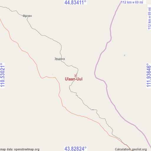
Ulaan-Uul GPS coordinates[2]
44° 19' 59.988" North, 111° 13' 59.988" East
| Map corner | latitude | longitude |
|---|---|---|
| Upper-left | 44.83411°, | 110.53021° |
| Center: | 44.33333°, | 111.23333° |
| Lower-right: | 43.82824°, | 111.93646° |
| Map W x H: | 111.8×111.8 km | = 69.5×69.5mi |
| max Lat: | 51.50725° ⇑95.1% North |
| Ulaan-Uul: | 44.33333° |
| min Lat: | ⇓4.9% South 42.84199° |
| min Long | Ulaan-Uul | max Long |
| 89.14358° | 111.23333° | 118.51014° |
| W 90.5%⇐ | ⇒9.5% E |
Elevation
Elevation of Ulaan-Uul is 999 m = 3278 ft, and this is 417.5 m = 1370 ft below average elevation for this country.
| Max E: |
2800 m = 9186 ft | 85.3% |
| Avg. | 1416.5 m = 4647 ft | |
| Ulaan-Uul | 999 m = 3278 ft | |
Min E: |
619 m = 2031 ft | 14.7% |
See also: Mongolia elevation on elevation.city.
Geographical zone
Ulaan-Uul is located in North temperate zone (between Tropic of Cancer and the Arctic Circle). Distance of this Northern Tropic circle is 2323.5 km =1443.8 mi to South.| Distance of | km | miles | from Ulaan-Uul |
|---|---|---|---|
| North Pole | 5077.7 | 3155.1 | to North |
| Arctic Circle | 2471.8 | 1535.9 | to North |
| Tropic Cancer | 2323.5 | 1443.8 | to South |
| Equator | 4929.4 | 3063 | to South |


Nearby cities:
15 places around Ulaan-Uul: (largest is in red/bold)
• Bayan
228.9 km =142.2 mi,  338°
338°
• Buyant
215.4 km =133.8 mi,  351°
351°
• Chandmanĭ
146.4 km =91 mi, 335°
• Ergel
213.9 km =132.9 mi,  232°
232°
• Havirga
207.7 km =129.1 mi,  44°
44°
• Hongor
163.1 km =101.3 mi,  359°
359°
• Hongor
213.1 km =132.4 mi,  65°
65°
• Khuvsget
151.1 km =93.9 mi,  237°
237°
• Nüden
103.5 km =64.3 mi,  216°
216°
• Saynshand
107.4 km =66.7 mi,  304°
304°
• Senj
56.4 km =35 mi,  319°
319°
• Sergelen
212.5 km =132 mi,  12°
12°
• Shireet
178.3 km =110.8 mi,  29°
29°
• Tsagaandörvölj
221.7 km =137.8 mi, 317°
• Öldziyt
180 km =111.8 mi,  282°
282°
Sources, notices
• [Note1] Compared only with cities in Mongolia existing in our database
• [Src1] Map data: © OpenStreetMap contributors (CC-BY-SA)
• [Src2] Other city data from geonames.org with taken over terms of usage.
• [Src3] Geographical zone / Annual Mean Temperature by Robert A. Rohde @ Wikipedia
