Saynshand geodata
Saynshand (East Gobi Aymag) is a seat of a first-order administrative division; located in Mongolia in Asia/Ulaanbaatar (GMT+8) time zone. With population of 19,891 people, there are 12 cities with bigger population in this country. Compared to other cities in Mongolia, 91.1% of cities are located further ↑North; 86.2% of cities are located further ←West and 88% of cities have higher elevation than Saynshand. Note1


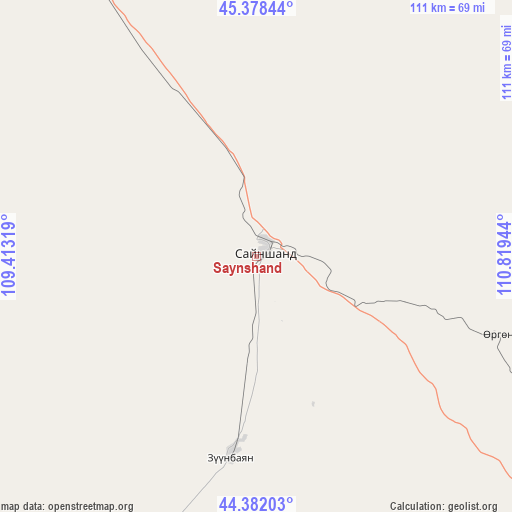
Saynshand GPS coordinates[2]
44° 52' 56.604" North, 110° 6' 58.716" East
| Map corner | latitude | longitude |
|---|---|---|
| Upper-left | 45.37844°, | 109.41319° |
| Center: | 44.88239°, | 110.11631° |
| Lower-right: | 44.38203°, | 110.81944° |
| Map W x H: | 110.8×110.8 km | = 68.8×68.8mi |
| max Lat: | 51.50725° ⇑91.1% North |
| Saynshand: | 44.88239° |
| min Lat: | ⇓8.9% South 42.84199° |
| min Long | Saynshand | max Long |
| 89.14358° | 110.11631° | 118.51014° |
| W 86.2%⇐ | ⇒13.8% E |
Elevation
Elevation of Saynshand is 947 m = 3107 ft, and this is 469.5 m = 1540 ft below average elevation for this country.
| Max E: |
2800 m = 9186 ft | 88% |
| Avg. | 1416.5 m = 4647 ft | |
| Saynshand | 947 m = 3107 ft | |
Min E: |
619 m = 2031 ft | 12% |
See also: Mongolia elevation on elevation.city.
Geographical zone
Saynshand is located in North temperate zone (between Tropic of Cancer and the Arctic Circle). Distance of this Northern Tropic circle is 2384.5 km =1481.7 mi to South.| Distance of | km | miles | from Saynshand |
|---|---|---|---|
| North Pole | 5016.6 | 3117.2 | to North |
| Arctic Circle | 2410.7 | 1497.9 | to North |
| Tropic Cancer | 2384.5 | 1481.7 | to South |
| Equator | 4990.5 | 3101 | to South |


Nearby cities:
15 places around Saynshand: (largest is in red/bold)
• Argatay
193.6 km =120.3 mi,  300°
300°
• Bayan
152.1 km =94.5 mi,  1°
1°
• Buyant
162 km =100.7 mi,  20°
20°
• Böhöt
149.2 km =92.7 mi,  285°
285°
• Chandmanĭ
77.4 km =48.1 mi, 20°
• Hongor
132.6 km =82.4 mi,  39°
39°
• Khuvsget
146.9 km =91.3 mi,  195°
195°
• Naran-mandokhu Somon
157.1 km =97.6 mi,  250°
250°
• Nüden
147.1 km =91.4 mi,  169°
169°
• Senj
54.5 km =33.9 mi,  109°
109°
• Shiveegovĭ
179.1 km =111.3 mi,  319°
319°
• Tsagaandörvölj
119.4 km =74.2 mi,  328°
328°
• Tsomog
141.2 km =87.7 mi, 324°
• Ulaan-Uul
107.4 km =66.7 mi,  124°
124°
• Öldziyt
89.6 km =55.7 mi,  255°
255°
Sources, notices
• [Note1] Compared only with cities in Mongolia existing in our database
• [Src1] Map data: © OpenStreetMap contributors (CC-BY-SA)
• [Src2] Other city data from geonames.org with taken over terms of usage.
• [Src3] Geographical zone / Annual Mean Temperature by Robert A. Rohde @ Wikipedia
