Nüden geodata
Nüden (East Gobi Aymag) is a seat of a second-order administrative division; located in Mongolia in Asia/Ulaanbaatar (GMT+8) time zone. In our database, there are 33 cities with bigger population. Compared to other cities in Mongolia, 97.2% of cities are located further ↑North; 87.4% of cities are located further ←West and 84% of cities have higher elevation than Nüden. Note1


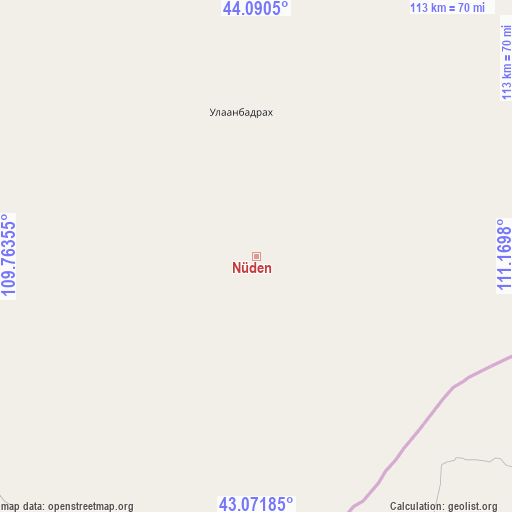
Nüden GPS coordinates[2]
43° 34' 59.988" North, 110° 28' 0.012" East
| Map corner | latitude | longitude |
|---|---|---|
| Upper-left | 44.0905°, | 109.76355° |
| Center: | 43.58333°, | 110.46667° |
| Lower-right: | 43.07185°, | 111.1698° |
| Map W x H: | 113.3×113.3 km | = 70.4×70.4mi |
| max Lat: | 51.50725° ⇑97.2% North |
| Nüden: | 43.58333° |
| min Lat: | ⇓2.8% South 42.84199° |
| min Long | Nüden | max Long |
| 89.14358° | 110.46667° | 118.51014° |
| W 87.4%⇐ | ⇒12.6% E |
Elevation
Elevation of Nüden is 1015 m = 3330 ft, and this is 401.5 m = 1317 ft below average elevation for this country.
| Max E: |
2800 m = 9186 ft | 84% |
| Avg. | 1416.5 m = 4647 ft | |
| Nüden | 1015 m = 3330 ft | |
Min E: |
619 m = 2031 ft | 16% |
See also: Mongolia elevation on elevation.city.
Geographical zone
Nüden is located in North temperate zone (between Tropic of Cancer and the Arctic Circle). Distance of this Northern Tropic circle is 2240.1 km =1391.9 mi to South.| Distance of | km | miles | from Nüden |
|---|---|---|---|
| North Pole | 5161 | 3206.9 | to North |
| Arctic Circle | 2555.2 | 1587.7 | to North |
| Tropic Cancer | 2240.1 | 1391.9 | to South |
| Equator | 4846 | 3011.2 | to South |


Nearby cities:
15 places around Nüden: (largest is in red/bold)
• Böhöt
252.4 km =156.8 mi,  316°
316°
• Chandmanĭ
216.8 km =134.7 mi,  0°
0°
• Ergel
118.1 km =73.4 mi,  245°
245°
• Hongor
253.2 km =157.3 mi,  13°
13°
• Ihbulag
267.3 km =166.1 mi,  260°
260°
• Khuvsget
66.8 km =41.5 mi,  272°
272°
• Naran-mandokhu Somon
199.2 km =123.8 mi,  297°
297°
• Saynshand
147.1 km =91.4 mi,  349°
349°
• Senj
128.3 km =79.7 mi, 10°
• Shireet
281.3 km =174.8 mi,  32°
32°
• Tsagaandörvölj
262.5 km =163.1 mi,  339°
339°
• Tsomog
282 km =175.2 mi, 336°
• Ulaan-Uul
103.5 km =64.3 mi,  36°
36°
• Öldziyt
168.4 km =104.6 mi, 316°
• Üydzen
293.8 km =182.6 mi,  280°
280°
Sources, notices
• [Note1] Compared only with cities in Mongolia existing in our database
• [Src1] Map data: © OpenStreetMap contributors (CC-BY-SA)
• [Src2] Other city data from geonames.org with taken over terms of usage.
• [Src3] Geographical zone / Annual Mean Temperature by Robert A. Rohde @ Wikipedia
