Hongor geodata
Hongor (East Gobi Aymag) is a seat of a second-order administrative division; located in Mongolia in Asia/Ulaanbaatar (GMT+8) time zone. In our database, there are 33 cities with bigger population. Compared to other cities in Mongolia, 82.5% of cities are located further ↑North; 90.2% of cities are located further ←West and 77.3% of cities have higher elevation than Hongor. Note1


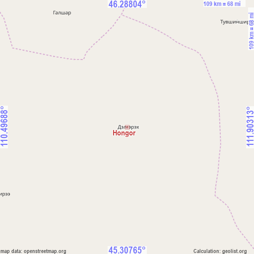
Hongor GPS coordinates[2]
45° 48' 0" North, 111° 12' 0" East
| Map corner | latitude | longitude |
|---|---|---|
| Upper-left | 46.28804°, | 110.49688° |
| Center: | 45.8°, | 111.2° |
| Lower-right: | 45.30765°, | 111.90313° |
| Map W x H: | 109×109 km | = 67.7×67.7mi |
| max Lat: | 51.50725° ⇑82.5% North |
| Hongor: | 45.8° |
| min Lat: | ⇓17.5% South 42.84199° |
| min Long | Hongor | max Long |
| 89.14358° | 111.2° | 118.51014° |
| W 90.2%⇐ | ⇒9.8% E |
Elevation
Elevation of Hongor is 1077 m = 3533 ft, and this is 339.5 m = 1114 ft below average elevation for this country.
| Max E: |
2800 m = 9186 ft | 77.3% |
| Avg. | 1416.5 m = 4647 ft | |
| Hongor | 1077 m = 3533 ft | |
Min E: |
619 m = 2031 ft | 22.7% |
See also: Mongolia elevation on elevation.city.
Geographical zone
Hongor is located in North temperate zone (between Tropic of Cancer and the Arctic Circle). Distance of this North polar circle is 2308.7 km =1434.6 mi to North.| Distance of | km | miles | from Hongor |
|---|---|---|---|
| North Pole | 4914.6 | 3053.8 | to North |
| Arctic Circle | 2308.7 | 1434.6 | to North |
| Tropic Cancer | 2486.6 | 1545.1 | to South |
| Equator | 5092.5 | 3164.3 | to South |


Nearby cities:
15 places around Hongor: (largest is in red/bold)
• Bayan
94.2 km =58.5 mi,  302°
302°
• Bayan
154.8 km =96.2 mi,  349°
349°
• Bayasgalant
146.8 km =91.2 mi,  26°
26°
• Buyant
57.5 km =35.7 mi,  330°
330°
• Chandmanĭ
64.2 km =39.9 mi,  242°
242°
• Darhan
164.5 km =102.2 mi, 303°
• Dzüünbulag
99.8 km =62 mi,  49°
49°
• Hatavch
141.2 km =87.7 mi,  73°
73°
• Havirga
146.9 km =91.3 mi,  95°
95°
• Saynshand
132.6 km =82.4 mi,  219°
219°
• Senj
125.1 km =77.7 mi,  195°
195°
• Sergelen
65.2 km =40.5 mi, 46°
• Shireet
90 km =55.9 mi, 95°
• Tsagaandörvölj
145.9 km =90.7 mi,  269°
269°
• Ulaan-Uul
163.1 km =101.3 mi,  179°
179°
Sources, notices
• [Note1] Compared only with cities in Mongolia existing in our database
• [Src1] Map data: © OpenStreetMap contributors (CC-BY-SA)
• [Src2] Other city data from geonames.org with taken over terms of usage.
• [Src3] Geographical zone / Annual Mean Temperature by Robert A. Rohde @ Wikipedia
