Maanĭt geodata
Maanĭt (Bulgan) is a seat of a second-order administrative division; located in Mongolia in Asia/Ulaanbaatar (GMT+8) time zone. In our database, there are 33 cities with bigger population. Compared to other cities in Mongolia, 63.5% of cities are located further ↓South; 53.7% of cities are located further ←West and 55.5% of cities have higher elevation than Maanĭt. Note1


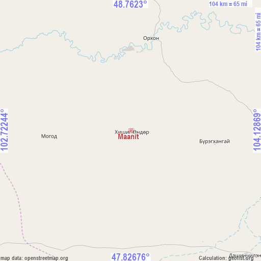
Maanĭt GPS coordinates[2]
48° 17' 48.012" North, 103° 25' 32.016" East
| Map corner | latitude | longitude |
|---|---|---|
| Upper-left | 48.7623°, | 102.72244° |
| Center: | 48.29667°, | 103.42556° |
| Lower-right: | 47.82676°, | 104.12869° |
| Map W x H: | 104×104 km | = 64.6×64.6mi |
| max Lat: | 51.50725° ⇑36.5% North |
| Maanĭt: | 48.29667° |
| min Lat: | ⇓63.5% South 42.84199° |
| min Long | Maanĭt | max Long |
| 89.14358° | 103.42556° | 118.51014° |
| W 53.7%⇐ | ⇒46.3% E |
Elevation
Elevation of Maanĭt is 1306 m = 4285 ft, and this is 110.5 m = 363 ft below average elevation for this country.
| Max E: |
2800 m = 9186 ft | 55.5% |
| Avg. | 1416.5 m = 4647 ft | |
| Maanĭt | 1306 m = 4285 ft | |
Min E: |
619 m = 2031 ft | 44.5% |
See also: Mongolia elevation on elevation.city.
Geographical zone
Maanĭt is located in North temperate zone (between Tropic of Cancer and the Arctic Circle). Distance of this North polar circle is 2031.1 km =1262.1 mi to North.| Distance of | km | miles | from Maanĭt |
|---|---|---|---|
| North Pole | 4637 | 2881.3 | to North |
| Arctic Circle | 2031.1 | 1262.1 | to North |
| Tropic Cancer | 2764.2 | 1717.6 | to South |
| Equator | 5370.1 | 3336.8 | to South |


Nearby cities:
15 places around Maanĭt: (largest is in red/bold)
• Avdzaga
74.1 km =46 mi,  174°
174°
• Bat-Öldziyt
100.2 km =62.3 mi,  95°
95°
• Bayan
96.4 km =59.9 mi,  192°
192°
• Bugat
87.4 km =54.3 mi,  11°
11°
• Bulgan
57.9 km =36 mi, 7°
• Darhan
34 km =21.1 mi, 97°
• Dashinchilling
68 km =42.3 mi,  136°
136°
• Dzegstey
95.6 km =59.4 mi,  222°
222°
• Erdenet
95.1 km =59.1 mi,  30°
30°
• Erhet
33 km =20.5 mi,  265°
265°
• Höshööt
68 km =42.3 mi,  251°
251°
• Hüremt
71.8 km =44.6 mi,  304°
304°
• Mandal
38 km =23.6 mi, 11°
• Tsul-Ulaan
95 km =59 mi,  122°
122°
• Uubulan
115.3 km =71.6 mi,  287°
287°
Sources, notices
• [Note1] Compared only with cities in Mongolia existing in our database
• [Src1] Map data: © OpenStreetMap contributors (CC-BY-SA)
• [Src2] Other city data from geonames.org with taken over terms of usage.
• [Src3] Geographical zone / Annual Mean Temperature by Robert A. Rohde @ Wikipedia
