Sharga geodata
Sharga (Hövsgöl) is a seat of a second-order administrative division; located in Mongolia in Asia/Ulaanbaatar (GMT+8) time zone. In our database, there are 33 cities with bigger population. Compared to other cities in Mongolia, 92% of cities are located further ↓South; 71.2% of cities are located further →East and 89.9% of cities have lower elevation than Sharga. Note1


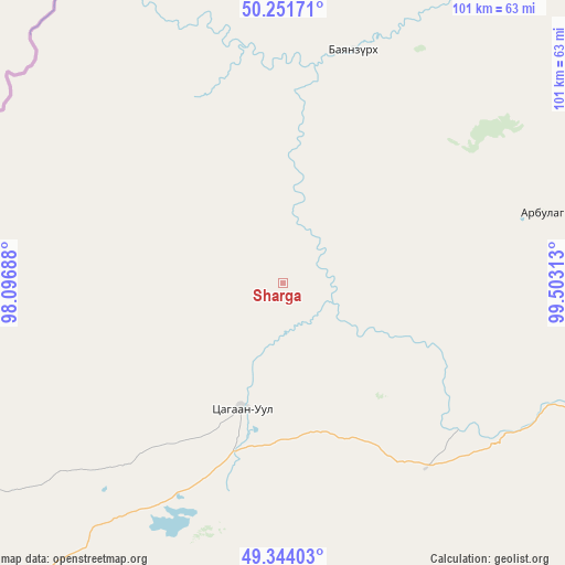
Sharga GPS coordinates[2]
49° 48' 0" North, 98° 48' 0" East
| Map corner | latitude | longitude |
|---|---|---|
| Upper-left | 50.25171°, | 98.09688° |
| Center: | 49.8°, | 98.8° |
| Lower-right: | 49.34403°, | 99.50313° |
| Map W x H: | 100.9×100.9 km | = 62.7×62.7mi |
| max Lat: | 51.50725° ⇑8% North |
| Sharga: | 49.8° |
| min Lat: | ⇓92% South 42.84199° |
| min Long | Sharga | max Long |
| 89.14358° | 98.8° | 118.51014° |
| W 28.8%⇐ | ⇒71.2% E |
Elevation
Elevation of Sharga is 2002 m = 6568 ft, and this is 585.5 m = 1921 ft above average elevation for this country.
| Max E: |
2800 m = 9186 ft | 10.1% |
| Sharga | 2002 m 6568 ft | |
| Avg. | 1416.5 m = 4647 ft | |
Min E: |
619 m = 2031 ft | 89.9% |
See also: Mongolia elevation on elevation.city.
Geographical zone
Sharga is located in North temperate zone (between Tropic of Cancer and the Arctic Circle). Distance of this North polar circle is 1863.9 km =1158.2 mi to North.| Distance of | km | miles | from Sharga |
|---|---|---|---|
| North Pole | 4469.8 | 2777.4 | to North |
| Arctic Circle | 1863.9 | 1158.2 | to North |
| Tropic Cancer | 2931.3 | 1821.4 | to South |
| Equator | 5537.2 | 3440.7 | to South |


Nearby cities:
15 places around Sharga: (largest is in red/bold)
• Altraga
43.9 km =27.3 mi,  16°
16°
• Asgat
147.5 km =91.7 mi,  257°
257°
• Bayan
70.6 km =43.9 mi,  125°
125°
• Bayan-Uhaa
120.2 km =74.7 mi,  180°
180°
• Bulag
131.2 km =81.5 mi,  87°
87°
• Erdenet
108.6 km =67.5 mi,  150°
150°
• Halban
82 km =51 mi,  248°
248°
• Ider
138.2 km =85.9 mi, 145°
• Jargalant
119.1 km =74 mi,  118°
118°
• Mandal
46.7 km =29 mi,  76°
76°
• Manhan
95.8 km =59.5 mi,  68°
68°
• Murun-kuren
99.7 km =62 mi,  100°
100°
• Orgil
140.7 km =87.4 mi,  163°
163°
• Tosontsengel
121.9 km =75.7 mi,  197°
197°
• Vlaa Vula
102.9 km =63.9 mi, 17°
Sources, notices
• [Note1] Compared only with cities in Mongolia existing in our database
• [Src1] Map data: © OpenStreetMap contributors (CC-BY-SA)
• [Src2] Other city data from geonames.org with taken over terms of usage.
• [Src3] Geographical zone / Annual Mean Temperature by Robert A. Rohde @ Wikipedia
