Bayan-Ovoo geodata
Bayan-Ovoo (Govĭ-Altay) is a seat of a second-order administrative division; located in Mongolia in Asia/Hovd (GMT+7) time zone. In our database, there are 33 cities with bigger population. Compared to other cities in Mongolia, 93.6% of cities are located further ↑North; 84% of cities are located further →East and 54.6% of cities have lower elevation than Bayan-Ovoo. Note1


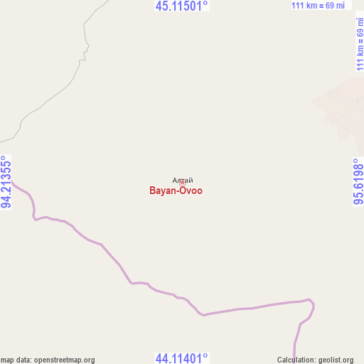
Bayan-Ovoo GPS coordinates[2]
44° 37' 0.012" North, 94° 55' 0.012" East
| Map corner | latitude | longitude |
|---|---|---|
| Upper-left | 45.11501°, | 94.21355° |
| Center: | 44.61667°, | 94.91667° |
| Lower-right: | 44.11401°, | 95.6198° |
| Map W x H: | 111.3×111.3 km | = 69.2×69.2mi |
| max Lat: | 51.50725° ⇑93.6% North |
| Bayan-Ovoo: | 44.61667° |
| min Lat: | ⇓6.4% South 42.84199° |
| min Long | Bayan-Ovoo | max Long |
| 89.14358° | 94.91667° | 118.51014° |
| W 16%⇐ | ⇒84% E |
Elevation
Elevation of Bayan-Ovoo is 1433 m = 4701 ft, and this is 16.5 m = 54 ft above average elevation for this country.
| Max E: |
2800 m = 9186 ft | 45.4% |
| Bayan-Ovoo | 1433 m 4701 ft | |
| Avg. | 1416.5 m = 4647 ft | |
Min E: |
619 m = 2031 ft | 54.6% |
See also: Mongolia elevation on elevation.city.
Geographical zone
Bayan-Ovoo is located in North temperate zone (between Tropic of Cancer and the Arctic Circle). Distance of this Northern Tropic circle is 2355 km =1463.3 mi to South.| Distance of | km | miles | from Bayan-Ovoo |
|---|---|---|---|
| North Pole | 5046.2 | 3135.6 | to North |
| Arctic Circle | 2440.3 | 1516.3 | to North |
| Tropic Cancer | 2355 | 1463.3 | to South |
| Equator | 4960.9 | 3082.6 | to South |


Nearby cities:
15 places around Bayan-Ovoo: (largest is in red/bold)
• Altai
221.4 km =137.6 mi,  28°
28°
• Altay sumu
244.7 km =152 mi,  302°
302°
• Bayangol
113.1 km =70.3 mi,  337°
337°
• Darvi
213.2 km =132.5 mi, 343°
• Dzüyl
203.8 km =126.6 mi, 337°
• Haliun
175.5 km =109.1 mi, 33°
• Jargalant
214.8 km =133.5 mi,  55°
55°
• Sangiyn Dalay
230.5 km =143.2 mi,  75°
75°
• Sharga
183.7 km =114.1 mi,  8°
8°
• Tahilt
158.4 km =98.4 mi, 59°
• Talshand
254 km =157.8 mi,  71°
71°
• Tsagaan-Olom
264.5 km =164.4 mi, 28°
• Tseel
129.3 km =80.3 mi,  35°
35°
• Tsetsegnuur
255.1 km =158.5 mi,  329°
329°
• Tögrög
135.1 km =83.9 mi,  356°
356°
Sources, notices
• [Note1] Compared only with cities in Mongolia existing in our database
• [Src1] Map data: © OpenStreetMap contributors (CC-BY-SA)
• [Src2] Other city data from geonames.org with taken over terms of usage.
• [Src3] Geographical zone / Annual Mean Temperature by Robert A. Rohde @ Wikipedia
