Tsetsegnuur geodata
Tsetsegnuur (Hovd) is a seat of a second-order administrative division; located in Mongolia in Asia/Hovd (GMT+7) time zone. In our database, there are 33 cities with bigger population. Compared to other cities in Mongolia, 69% of cities are located further ↑North; 88.7% of cities are located further →East and 76.1% of cities have lower elevation than Tsetsegnuur. Note1


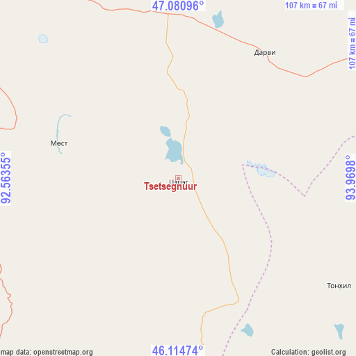
Tsetsegnuur GPS coordinates[2]
46° 36' 0" North, 93° 16' 0.012" East
| Map corner | latitude | longitude |
|---|---|---|
| Upper-left | 47.08096°, | 92.56355° |
| Center: | 46.6°, | 93.26667° |
| Lower-right: | 46.11474°, | 93.9698° |
| Map W x H: | 107.4×107.4 km | = 66.7×66.7mi |
| max Lat: | 51.50725° ⇑69% North |
| Tsetsegnuur: | 46.6° |
| min Lat: | ⇓31% South 42.84199° |
| min Long | Tsetsegnuur | max Long |
| 89.14358° | 93.26667° | 118.51014° |
| W 11.3%⇐ | ⇒88.7% E |
Elevation
Elevation of Tsetsegnuur is 1709 m = 5607 ft, and this is 292.5 m = 960 ft above average elevation for this country.
| Max E: |
2800 m = 9186 ft | 23.9% |
| Tsetsegnuur | 1709 m 5607 ft | |
| Avg. | 1416.5 m = 4647 ft | |
Min E: |
619 m = 2031 ft | 76.1% |
See also: Mongolia elevation on elevation.city.
Geographical zone
Tsetsegnuur is located in North temperate zone (between Tropic of Cancer and the Arctic Circle). Distance of this North polar circle is 2219.7 km =1379.3 mi to North.| Distance of | km | miles | from Tsetsegnuur |
|---|---|---|---|
| North Pole | 4825.6 | 2998.5 | to North |
| Arctic Circle | 2219.7 | 1379.3 | to North |
| Tropic Cancer | 2575.5 | 1600.3 | to South |
| Equator | 5181.4 | 3219.6 | to South |


Nearby cities:
15 places around Tsetsegnuur: (largest is in red/bold)
• Altanteel
65.2 km =40.5 mi,  330°
330°
• Altay sumu
116.8 km =72.6 mi,  220°
220°
• Bayan
153.5 km =95.4 mi,  73°
73°
• Bayangol
143.6 km =89.2 mi,  143°
143°
• Bürenhayrhan
143.5 km =89.2 mi,  246°
246°
• Darvi
46 km =28.6 mi,  35°
35°
• Darvi
67.1 km =41.7 mi,  104°
104°
• Dzüyl
58.7 km =36.5 mi,  123°
123°
• Sayn-Ust
127.3 km =79.1 mi,  48°
48°
• Tsenher
94.4 km =58.7 mi,  291°
291°
• Tögrög
121 km =75.2 mi,  319°
319°
• Tögrög
146.7 km =91.2 mi,  125°
125°
• Ulaantolgoy
38 km =23.6 mi,  284°
284°
• Urdgol
144.8 km =90 mi,  341°
341°
• Uyenchi Somon
113.8 km =70.7 mi,  237°
237°
Sources, notices
• [Note1] Compared only with cities in Mongolia existing in our database
• [Src1] Map data: © OpenStreetMap contributors (CC-BY-SA)
• [Src2] Other city data from geonames.org with taken over terms of usage.
• [Src3] Geographical zone / Annual Mean Temperature by Robert A. Rohde @ Wikipedia
