Bayan geodata
Bayan (Govĭ-Altay) is a seat of a second-order administrative division; located in Mongolia in Asia/Hovd (GMT+7) time zone. In our database, there are 33 cities with bigger population. Compared to other cities in Mongolia, 60.7% of cities are located further ↑North; 83.1% of cities are located further →East and 82.8% of cities have lower elevation than Bayan. Note1


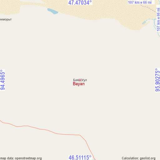
Bayan GPS coordinates[2]
46° 59' 34.44" North, 95° 11' 58.632" East
| Map corner | latitude | longitude |
|---|---|---|
| Upper-left | 47.47034°, | 94.4965° |
| Center: | 46.9929°, | 95.19962° |
| Lower-right: | 46.51115°, | 95.90275° |
| Map W x H: | 106.7×106.7 km | = 66.3×66.3mi |
| max Lat: | 51.50725° ⇑60.7% North |
| Bayan: | 46.9929° |
| min Lat: | ⇓39.3% South 42.84199° |
| min Long | Bayan | max Long |
| 89.14358° | 95.19962° | 118.51014° |
| W 16.9%⇐ | ⇒83.1% E |
Elevation
Elevation of Bayan is 1848 m = 6063 ft, and this is 431.5 m = 1416 ft above average elevation for this country.
| Max E: |
2800 m = 9186 ft | 17.2% |
| Bayan | 1848 m 6063 ft | |
| Avg. | 1416.5 m = 4647 ft | |
Min E: |
619 m = 2031 ft | 82.8% |
See also: Mongolia elevation on elevation.city.
Geographical zone
Bayan is located in North temperate zone (between Tropic of Cancer and the Arctic Circle). Distance of this North polar circle is 2176.1 km =1352.2 mi to North.| Distance of | km | miles | from Bayan |
|---|---|---|---|
| North Pole | 4781.9 | 2971.3 | to North |
| Arctic Circle | 2176.1 | 1352.2 | to North |
| Tropic Cancer | 2619.2 | 1627.5 | to South |
| Equator | 5225.1 | 3246.7 | to South |


Nearby cities:
15 places around Bayan: (largest is in red/bold)
• Aldar
124 km =77.1 mi,  54°
54°
• Altai
106.2 km =66 mi,  130°
130°
• Altan
130.8 km =81.3 mi,  17°
17°
• Buga
74.6 km =46.4 mi,  348°
348°
• Buyanbat
55.1 km =34.2 mi,  91°
91°
• Darvi
102.3 km =63.6 mi,  233°
233°
• Darvi
120.3 km =74.8 mi,  267°
267°
• Dzüyl
124.9 km =77.6 mi, 232°
• Haliun
139.3 km =86.6 mi,  148°
148°
• Sayn-Ust
65.2 km =40.5 mi,  308°
308°
• Sharga
82.8 km =51.4 mi,  176°
176°
• Shiree
133.4 km =82.9 mi,  65°
65°
• Tsagaan-Olom
105.5 km =65.6 mi,  107°
107°
• Tsagaanchuluut
112.3 km =69.8 mi,  83°
83°
• Tögrög
132.6 km =82.4 mi,  192°
192°
Sources, notices
• [Note1] Compared only with cities in Mongolia existing in our database
• [Src1] Map data: © OpenStreetMap contributors (CC-BY-SA)
• [Src2] Other city data from geonames.org with taken over terms of usage.
• [Src3] Geographical zone / Annual Mean Temperature by Robert A. Rohde @ Wikipedia
