Santa Cruz geodata
Santa Cruz (Veracruz) is a populated place; located in Mexico in America/Mexico_City (GMT-6) time zone. With population of 758 people, there are 11551 cities with bigger population in this country. Compared to other cities in Mexico, 73.2% of cities are located further ↓South; 58.4% of cities are located further ←West and 61.2% of cities have higher elevation than Santa Cruz. Note1


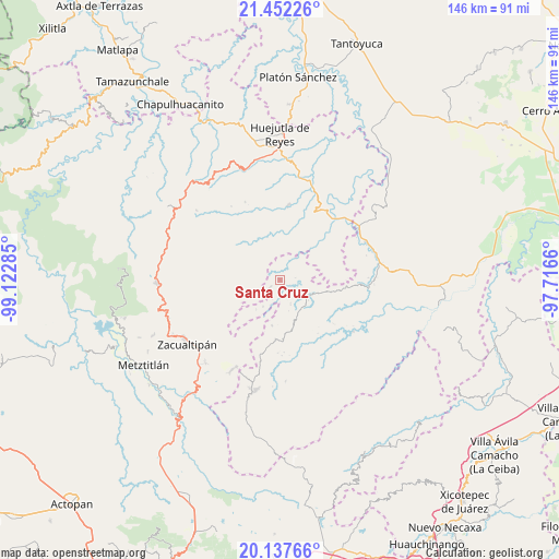
Santa Cruz GPS coordinates[2]
20° 47' 47.004" North, 98° 25' 10.992" West
| Map corner | latitude | longitude |
|---|---|---|
| Upper-left | 21.45226°, | -99.12285° |
| Center: | 20.79639°, | -98.41972° |
| Lower-right: | 20.13766°, | -97.7166° |
| Map W x H: | 146.2×146.2 km | = 90.8×90.8mi |
| max Lat: | 32.7° ⇑26.8% North |
| Santa Cruz: | 20.79639° |
| min Lat: | ⇓73.2% South 14.53588° |
| min Long | Santa Cruz | max Long |
| -117.105° | -98.41972° | -86.73105° |
| W 58.4%⇐ | ⇒41.6% E |
Elevation
Elevation of Santa Cruz is 924 m = 3031 ft, and this is 329.7 m = 1082 ft below average elevation for this country.
| Max E: |
3497 m = 11473 ft | 61.2% |
| Avg. | 1253.7 m = 4113 ft | |
| Santa Cruz | 924 m = 3031 ft | |
Min E: |
-1 m = -3 ft | 38.8% |
See also: Mexico elevation on elevation.city.
Geographical zone
Santa Cruz is located in North Torrid zone (between Equator and Tropic of Cancer). Distance of this Northern Tropic circle is 293.6 km =182.4 mi to North.| Distance of | km | miles | from Santa Cruz |
|---|---|---|---|
| North Pole | 7694.7 | 4781.3 | to North |
| Arctic Circle | 5088.8 | 3162 | to North |
| Tropic Cancer | 293.6 | 182.4 | to North |
| Equator | 2312.3 | 1436.8 | to South |


Nearby cities:
15 places around Santa Cruz: (largest is in red/bold)
• Aguacatitla
7.3 km =4.5 mi,  353°
353°
• Arnatepec
1.3 km =0.8 mi,  109°
109°
• Atempa
4.6 km =2.9 mi,  175°
175°
• Chahuatlán
3.1 km =1.9 mi,  118°
118°
• Coacoaco
3.9 km =2.4 mi,  332°
332°
• Huitztipan
7.4 km =4.6 mi,  52°
52°
• Ilamatlán
3 km =1.9 mi,  234°
234°
• José María Pino Suárez
6.8 km =4.2 mi,  156°
156°
• San Gregorio
4 km =2.5 mi, 48°
• Tecapa
8.3 km =5.2 mi,  212°
212°
• Tlatlazoquico
7.1 km =4.4 mi,  67°
67°
• Xalacahuantla
7.7 km =4.8 mi,  261°
261°
• Xococapa
7.3 km =4.5 mi,  78°
78°
• Xoxolpa
8.8 km =5.5 mi,  357°
357°
• Zontecomatlán de López y Fuentes
8.8 km =5.5 mi, 115°
Sources, notices
• [Note1] Compared only with cities in Mexico existing in our database
• [Src1] Map data: © OpenStreetMap contributors (CC-BY-SA)
• [Src2] Other city data from geonames.org with taken over terms of usage.
• [Src3] Geographical zone / Annual Mean Temperature by Robert A. Rohde @ Wikipedia
