Atexcal geodata
Atexcal (Puebla) is a populated place; located in Mexico in America/Mexico_City (GMT-6) time zone. With population of 957 people, there are 9106 cities with bigger population in this country. Compared to other cities in Mexico, 73.8% of cities are located further ↑North; 66.8% of cities are located further ←West and 64.8% of cities have lower elevation than Atexcal. Note1


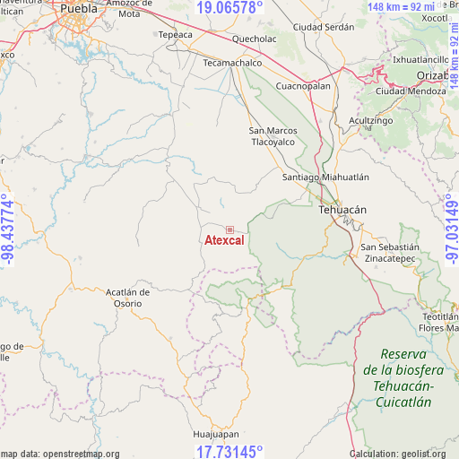
Atexcal GPS coordinates[2]
18° 23' 59.676" North, 97° 44' 4.596" West
| Map corner | latitude | longitude |
|---|---|---|
| Upper-left | 19.06578°, | -98.43774° |
| Center: | 18.39991°, | -97.73461° |
| Lower-right: | 17.73145°, | -97.03149° |
| Map W x H: | 148.4×148.4 km | = 92.2×92.2mi |
| max Lat: | 32.7° ⇑73.8% North |
| Atexcal: | 18.39991° |
| min Lat: | ⇓26.2% South 14.53588° |
| min Long | Atexcal | max Long |
| -117.105° | -97.73461° | -86.73105° |
| W 66.8%⇐ | ⇒33.2% E |
Elevation
Elevation of Atexcal is 1823 m = 5981 ft, and this is 569.3 m = 1868 ft above average elevation for this country.
| Max E: |
3497 m = 11473 ft | 35.2% |
| Atexcal | 1823 m 5981 ft | |
| Avg. | 1253.7 m = 4113 ft | |
Min E: |
-1 m = -3 ft | 64.8% |
See also: Mexico elevation on elevation.city.
Geographical zone
Atexcal is located in North Torrid zone (between Equator and Tropic of Cancer). Distance of this Northern Tropic circle is 560 km =348 mi to North.| Distance of | km | miles | from Atexcal |
|---|---|---|---|
| North Pole | 7961.2 | 4946.9 | to North |
| Arctic Circle | 5355.3 | 3327.6 | to North |
| Tropic Cancer | 560 | 348 | to North |
| Equator | 2045.9 | 1271.3 | to South |


Nearby cities:
15 places around Atexcal: (largest is in red/bold)
• El Progreso
22.1 km =13.7 mi,  324°
324°
• Guadalupe Victoria
19.2 km =11.9 mi, 322°
• Huejonapan
21.2 km =13.2 mi,  291°
291°
• Juan N. Méndez
16.4 km =10.2 mi,  346°
346°
• Magdalena Alquizapán
9.5 km =5.9 mi,  343°
343°
• Mariscala
23.4 km =14.5 mi,  304°
304°
• San Felipe Otlaltepec
18.3 km =11.4 mi,  270°
270°
• San Juan Ixcaquixtla
12.2 km =7.6 mi, 303°
• San Lucas
12.9 km =8 mi,  112°
112°
• San Mateo Zoyamazalco
7.3 km =4.5 mi, 288°
• San Vicente Coyotepec
10 km =6.2 mi, 272°
• Santa María la Alta
23.6 km =14.7 mi,  19°
19°
• Teloxtoc
16.5 km =10.3 mi,  98°
98°
• Teontepec
23.9 km =14.9 mi,  64°
64°
• Totoltepec de Guerrero
23.2 km =14.4 mi,  213°
213°
Sources, notices
• [Note1] Compared only with cities in Mexico existing in our database
• [Src1] Map data: © OpenStreetMap contributors (CC-BY-SA)
• [Src2] Other city data from geonames.org with taken over terms of usage.
• [Src3] Geographical zone / Annual Mean Temperature by Robert A. Rohde @ Wikipedia
