San Miguel Tlaltepexi geodata
San Miguel Tlaltepexi (Puebla) is a populated place; located in Mexico in America/Mexico_City (GMT-6) time zone. With population of 866 people, there are 10100 cities with bigger population in this country. Compared to other cities in Mexico, 79.6% of cities are located further ↑North; 58.3% of cities are located further ←West and 56.7% of cities have higher elevation than San Miguel Tlaltepexi. Note1
Current local time in San Miguel Tlaltepexi:
08:32 AM, WednesdayDifference from your time zone: hours


San Miguel Tlaltepexi GPS coordinates[2]
17° 54' 54" North, 98° 25' 23.016" West
| Map corner | latitude | longitude |
|---|---|---|
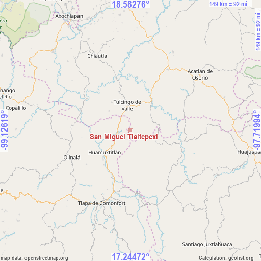
| Upper-left | 18.58276°, | -99.12619° |
| Center: | 17.915°, | -98.42306° |
| Lower-right: | 17.24472°, | -97.71994° |
| Map W x H: | 148.8×148.8 km | = 92.5×92.5mi |
| max Lat: | 32.7° ⇑79.6% North |
| San Miguel Tlaltepexi: | 17.915° |
| min Lat: | ⇓20.4% South 14.53588° |
| min Long | San Miguel Tlal | max Long |
| -117.105° | -98.42306° | -86.73105° |
| W 58.3%⇐ | ⇒41.7% E |
Elevation
Elevation of San Miguel Tlaltepexi is 1131 m = 3711 ft, and this is 122.7 m = 403 ft below average elevation for this country.
| Max E: |
3497 m = 11473 ft | 56.7% |
| Avg. | 1253.7 m = 4113 ft | |
| San Miguel Tlaltepexi | 1131 m = 3711 ft | |
Min E: |
-1 m = -3 ft | 43.3% |
See also: Mexico elevation on elevation.city.
Geographical zone
San Miguel Tlaltepexi is located in North Torrid zone (between Equator and Tropic of Cancer). Distance of this Northern Tropic circle is 614 km =381.5 mi to North.| Distance of | km | miles | from San Miguel Tlaltepexi |
|---|---|---|---|
| North Pole | 8015.1 | 4980.4 | to North |
| Arctic Circle | 5409.2 | 3361.1 | to North |
| Tropic Cancer | 614 | 381.5 | to North |
| Equator | 1992 | 1237.8 | to South |


Nearby cities:
15 places around San Miguel Tlaltepexi: (largest is in red/bold)
• Acaxtlahuacán de Albino Zertuche
16.8 km =10.4 mi,  312°
312°
• Guadalupe Victoria
8 km =5 mi,  29°
29°
• Guadalupe del Recreo
16 km =9.9 mi,  143°
143°
• Huamuxtitlán
19.3 km =12 mi,  230°
230°
• Olomatlán
16.6 km =10.3 mi,  78°
78°
• Progreso
18 km =11.2 mi,  40°
40°
• San Juan la Ciénega
16.7 km =10.4 mi,  115°
115°
• San Miguel Comitlipa
14.7 km =9.1 mi,  292°
292°
• Santa Ana Rayón
15.5 km =9.6 mi,  112°
112°
• Toltecamila
21.3 km =13.2 mi,  284°
284°
• Tulcingo de Valle
14.4 km =8.9 mi,  352°
352°
• Xicotlán
19.3 km =12 mi,  326°
326°
• Xixingo de los Reyes
2.9 km =1.8 mi, 141°
• Xochihuehuetlán
7 km =4.3 mi,  261°
261°
• Zapotitlán Lagunas
18 km =11.2 mi,  168°
168°
Sources, notices
• [Note1] Compared only with cities in Mexico existing in our database
• [Src1] Map data: © OpenStreetMap contributors (CC-BY-SA)
• [Src2] Other city data from geonames.org with taken over terms of usage.
• [Src3] Geographical zone / Annual Mean Temperature by Robert A. Rohde @ Wikipedia
