Oxtotitlán geodata
Oxtotitlán (Guerrero) is a populated place; located in Mexico in America/Mexico_City (GMT-6) time zone. With population of 2,104 people, there are 4151 cities with bigger population in this country. Compared to other cities in Mexico, 76.3% of cities are located further ↑North; 63% of cities are located further →East and 58.6% of cities have higher elevation than Oxtotitlán. Note1


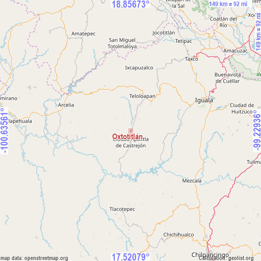
Oxtotitlán GPS coordinates[2]
18° 11' 24.144" North, 99° 55' 56.928" West
| Map corner | latitude | longitude |
|---|---|---|
| Upper-left | 18.85673°, | -100.63561° |
| Center: | 18.19004°, | -99.93248° |
| Lower-right: | 17.52079°, | -99.22936° |
| Map W x H: | 148.5×148.5 km | = 92.3×92.3mi |
| max Lat: | 32.7° ⇑76.3% North |
| Oxtotitlán: | 18.19004° |
| min Lat: | ⇓23.7% South 14.53588° |
| min Long | Oxtotitlán | max Long |
| -117.105° | -99.93248° | -86.73105° |
| W 37%⇐ | ⇒63% E |
Elevation
Elevation of Oxtotitlán is 1074 m = 3524 ft, and this is 179.7 m = 590 ft below average elevation for this country.
| Max E: |
3497 m = 11473 ft | 58.6% |
| Avg. | 1253.7 m = 4113 ft | |
| Oxtotitlán | 1074 m = 3524 ft | |
Min E: |
-1 m = -3 ft | 41.4% |
See also: Mexico elevation on elevation.city.
Geographical zone
Oxtotitlán is located in North Torrid zone (between Equator and Tropic of Cancer). Distance of this Northern Tropic circle is 583.4 km =362.5 mi to North.| Distance of | km | miles | from Oxtotitlán |
|---|---|---|---|
| North Pole | 7984.5 | 4961.3 | to North |
| Arctic Circle | 5378.6 | 3342.1 | to North |
| Tropic Cancer | 583.4 | 362.5 | to North |
| Equator | 2022.5 | 1256.7 | to South |


Nearby cities:
15 places around Oxtotitlán: (largest is in red/bold)
• Acatempan
15.2 km =9.4 mi,  20°
20°
• Ahuaxotitla
16.6 km =10.3 mi,  106°
106°
• Apaxtla de Castrejón
6.5 km =4 mi,  180°
180°
• Apetlanca
15.3 km =9.5 mi,  82°
82°
• Colonia el Pedregal
19.5 km =12.1 mi, 24°
• Cuaxilotla
8.8 km =5.5 mi,  103°
103°
• Cuetzala del Progreso
12.3 km =7.6 mi,  120°
120°
• El Calvario
16.6 km =10.3 mi,  48°
48°
• El Capire
16.1 km =10 mi,  358°
358°
• Los Sauces
13.4 km =8.3 mi, 50°
• Tehuixtla
14.1 km =8.8 mi, 359°
• Tianquizolco
19.1 km =11.9 mi, 78°
• Tlacaquipa
7.6 km =4.7 mi,  57°
57°
• Tlanipatlán
19.8 km =12.3 mi, 99°
• Totoltepec
14.9 km =9.3 mi,  309°
309°
Sources, notices
• [Note1] Compared only with cities in Mexico existing in our database
• [Src1] Map data: © OpenStreetMap contributors (CC-BY-SA)
• [Src2] Other city data from geonames.org with taken over terms of usage.
• [Src3] Geographical zone / Annual Mean Temperature by Robert A. Rohde @ Wikipedia
