Totoltepec geodata
Totoltepec (Guerrero) is a populated place; located in Mexico in America/Mexico_City (GMT-6) time zone. With population of 554 people, there are 15392 cities with bigger population in this country. Compared to other cities in Mexico, 75.2% of cities are located further ↑North; 64.5% of cities are located further →East and 53.3% of cities have lower elevation than Totoltepec. Note1


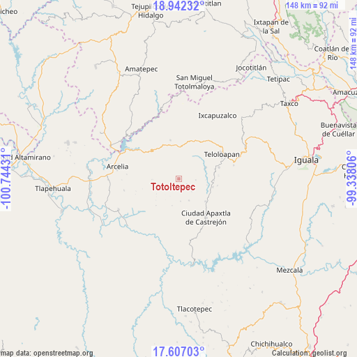
Totoltepec GPS coordinates[2]
18° 16' 33.456" North, 100° 2' 28.248" West
| Map corner | latitude | longitude |
|---|---|---|
| Upper-left | 18.94232°, | -100.74431° |
| Center: | 18.27596°, | -100.04118° |
| Lower-right: | 17.60703°, | -99.33806° |
| Map W x H: | 148.5×148.5 km | = 92.3×92.3mi |
| max Lat: | 32.7° ⇑75.2% North |
| Totoltepec: | 18.27596° |
| min Lat: | ⇓24.8% South 14.53588° |
| min Long | Totoltepec | max Long |
| -117.105° | -100.04118° | -86.73105° |
| W 35.5%⇐ | ⇒64.5% E |
Elevation
Elevation of Totoltepec is 1546 m = 5072 ft, and this is 292.3 m = 959 ft above average elevation for this country.
| Max E: |
3497 m = 11473 ft | 46.7% |
| Totoltepec | 1546 m 5072 ft | |
| Avg. | 1253.7 m = 4113 ft | |
Min E: |
-1 m = -3 ft | 53.3% |
See also: Mexico elevation on elevation.city.
Geographical zone
Totoltepec is located in North Torrid zone (between Equator and Tropic of Cancer). Distance of this Northern Tropic circle is 573.8 km =356.5 mi to North.| Distance of | km | miles | from Totoltepec |
|---|---|---|---|
| North Pole | 7975 | 4955.4 | to North |
| Arctic Circle | 5369.1 | 3336.2 | to North |
| Tropic Cancer | 573.8 | 356.5 | to North |
| Equator | 2032.1 | 1262.7 | to South |


Nearby cities:
15 places around Totoltepec: (largest is in red/bold)
• Acapetlahuaya
16.3 km =10.1 mi,  348°
348°
• Acatempan
17.3 km =10.7 mi,  74°
74°
• Acatlán de la Cruz
17.4 km =10.8 mi,  39°
39°
• Almoloya
17.5 km =10.9 mi,  305°
305°
• Apaxtla de Castrejón
19.8 km =12.3 mi,  144°
144°
• Cerro Alto
14.3 km =8.9 mi, 38°
• Colonia el Pedregal
21.2 km =13.2 mi, 67°
• Cuaxilotla
23.2 km =14.4 mi,  120°
120°
• El Capire
12.9 km =8 mi,  59°
59°
• Los Sauces
21.8 km =13.5 mi,  92°
92°
• Lídice
21.4 km =13.3 mi,  6°
6°
• Oxtotitlán
14.9 km =9.3 mi,  129°
129°
• Tehuixtla
12.3 km =7.6 mi, 68°
• Teloloapan
20.5 km =12.7 mi, 60°
• Tlacaquipa
18.7 km =11.6 mi,  107°
107°
Sources, notices
• [Note1] Compared only with cities in Mexico existing in our database
• [Src1] Map data: © OpenStreetMap contributors (CC-BY-SA)
• [Src2] Other city data from geonames.org with taken over terms of usage.
• [Src3] Geographical zone / Annual Mean Temperature by Robert A. Rohde @ Wikipedia
