Tlacaquipa geodata
Tlacaquipa (Guerrero) is a populated place; located in Mexico in America/Mexico_City (GMT-6) time zone. With population of 757 people, there are 11569 cities with bigger population in this country. Compared to other cities in Mexico, 75.9% of cities are located further ↑North; 62.3% of cities are located further →East and 53% of cities have lower elevation than Tlacaquipa. Note1


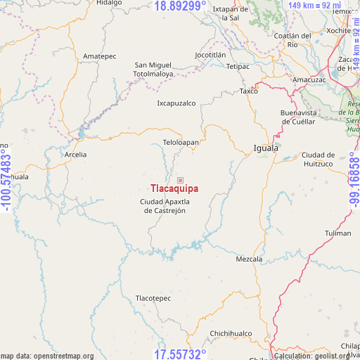
Tlacaquipa GPS coordinates[2]
18° 13' 35.184" North, 99° 52' 18.12" West
| Map corner | latitude | longitude |
|---|---|---|
| Upper-left | 18.89299°, | -100.57483° |
| Center: | 18.22644°, | -99.8717° |
| Lower-right: | 17.55732°, | -99.16858° |
| Map W x H: | 148.5×148.5 km | = 92.3×92.3mi |
| max Lat: | 32.7° ⇑75.9% North |
| Tlacaquipa: | 18.22644° |
| min Lat: | ⇓24.1% South 14.53588° |
| min Long | Tlacaquipa | max Long |
| -117.105° | -99.8717° | -86.73105° |
| W 37.7%⇐ | ⇒62.3% E |
Elevation
Elevation of Tlacaquipa is 1542 m = 5059 ft, and this is 288.3 m = 946 ft above average elevation for this country.
| Max E: |
3497 m = 11473 ft | 47% |
| Tlacaquipa | 1542 m 5059 ft | |
| Avg. | 1253.7 m = 4113 ft | |
Min E: |
-1 m = -3 ft | 53% |
See also: Mexico elevation on elevation.city.
Geographical zone
Tlacaquipa is located in North Torrid zone (between Equator and Tropic of Cancer). Distance of this Northern Tropic circle is 579.3 km =360 mi to North.| Distance of | km | miles | from Tlacaquipa |
|---|---|---|---|
| North Pole | 7980.5 | 4958.9 | to North |
| Arctic Circle | 5374.6 | 3339.6 | to North |
| Tropic Cancer | 579.3 | 360 | to North |
| Equator | 2026.6 | 1259.3 | to South |


Nearby cities:
15 places around Tlacaquipa: (largest is in red/bold)
• Acatempan
10.3 km =6.4 mi,  353°
353°
• Ahuaxotitla
13 km =8.1 mi,  133°
133°
• Apaxtla de Castrejón
12.4 km =7.7 mi,  211°
211°
• Apetlanca
9 km =5.6 mi,  103°
103°
• Chilacachapa
12.8 km =8 mi,  65°
65°
• Colonia el Pedregal
13.8 km =8.6 mi,  6°
6°
• Cuaxilotla
6.5 km =4 mi,  160°
160°
• Cuetzala del Progreso
11 km =6.8 mi, 157°
• El Calvario
9.2 km =5.7 mi,  40°
40°
• El Capire
13.8 km =8.6 mi,  330°
330°
• Los Sauces
5.9 km =3.7 mi, 40°
• Oxtotitlán
7.6 km =4.7 mi,  237°
237°
• Tehuixtla
12 km =7.5 mi, 327°
• Tianquizolco
12.3 km =7.6 mi,  91°
91°
• Tlanipatlán
15.1 km =9.4 mi,  119°
119°
Sources, notices
• [Note1] Compared only with cities in Mexico existing in our database
• [Src1] Map data: © OpenStreetMap contributors (CC-BY-SA)
• [Src2] Other city data from geonames.org with taken over terms of usage.
• [Src3] Geographical zone / Annual Mean Temperature by Robert A. Rohde @ Wikipedia
