Cuyamiapa geodata
Cuyamiapa (Chiapas) is a populated place; located in Mexico in America/Mexico_City (GMT-6) time zone. With population of 887 people, there are 9835 cities with bigger population in this country. Compared to other cities in Mexico, 99.4% of cities are located further ↑North; 92.6% of cities are located further ←West and 88.3% of cities have higher elevation than Cuyamiapa. Note1


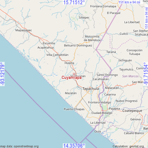
Cuyamiapa GPS coordinates[2]
15° 2' 13.812" North, 92° 25' 7.176" West
| Map corner | latitude | longitude |
|---|---|---|
| Upper-left | 15.71512°, | -93.12179° |
| Center: | 15.03717°, | -92.41866° |
| Lower-right: | 14.35706°, | -91.71554° |
| Map W x H: | 151×151 km | = 93.8×93.8mi |
| max Lat: | 32.7° ⇑99.4% North |
| Cuyamiapa: | 15.03717° |
| min Lat: | ⇓0.6% South 14.53588° |
| min Long | Cuyamiapa | max Long |
| -117.105° | -92.41866° | -86.73105° |
| W 92.6%⇐ | ⇒7.4% E |
Elevation
Elevation of Cuyamiapa is 29 m = 95 ft, and this is 1224.7 m = 4018 ft below average elevation for this country.
| Max E: |
3497 m = 11473 ft | 88.3% |
| Avg. | 1253.7 m = 4113 ft | |
| Cuyamiapa | 29 m = 95 ft | |
Min E: |
-1 m = -3 ft | 11.7% |
See also: Mexico elevation on elevation.city.
Geographical zone
Cuyamiapa is located in North Torrid zone (between Equator and Tropic of Cancer). Distance of this Northern Tropic circle is 933.9 km =580.3 mi to North.| Distance of | km | miles | from Cuyamiapa |
|---|---|---|---|
| North Pole | 8335.1 | 5179.2 | to North |
| Arctic Circle | 5729.2 | 3560 | to North |
| Tropic Cancer | 933.9 | 580.3 | to North |
| Equator | 1672 | 1038.9 | to South |


Nearby cities:
15 places around Cuyamiapa: (largest is in red/bold)
• Cantón la Lima
2.1 km =1.3 mi,  232°
232°
• Chamulapa
2.4 km =1.5 mi,  40°
40°
• Chamulapita
6.4 km =4 mi,  56°
56°
• Cuarto Cantón
6.5 km =4 mi,  337°
337°
• Cuntalapa
2.6 km =1.6 mi,  116°
116°
• El Arenal
8.9 km =5.5 mi,  305°
305°
• Estación Huehuetán
3.2 km =2 mi,  156°
156°
• Estación Tuzantán
8.4 km =5.2 mi, 335°
• Guachipilín
6.1 km =3.8 mi,  192°
192°
• Huehuetán
4.3 km =2.7 mi, 116°
• Nueva Victoria
6.2 km =3.9 mi,  251°
251°
• Plan de Ayala
8.6 km =5.3 mi, 226°
• San José el Amate
5.1 km =3.2 mi,  203°
203°
• Segundo Cantón
7.3 km =4.5 mi,  345°
345°
• Villa Hidalgo
9.1 km =5.7 mi,  31°
31°
Sources, notices
• [Note1] Compared only with cities in Mexico existing in our database
• [Src1] Map data: © OpenStreetMap contributors (CC-BY-SA)
• [Src2] Other city data from geonames.org with taken over terms of usage.
• [Src3] Geographical zone / Annual Mean Temperature by Robert A. Rohde @ Wikipedia
