Colotlipa geodata
Colotlipa (Guerrero) is a populated place; located in Mexico in America/Mexico_City (GMT-6) time zone. With population of 3,531 people, there are 2583 cities with bigger population in this country. Compared to other cities in Mexico, 84% of cities are located further ↑North; 52.1% of cities are located further →East and 64% of cities have higher elevation than Colotlipa. Note1


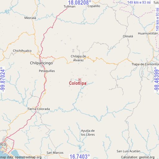
Colotlipa GPS coordinates[2]
17° 24' 44.712" North, 99° 10' 1.596" West
| Map corner | latitude | longitude |
|---|---|---|
| Upper-left | 18.08208°, | -99.87024° |
| Center: | 17.41242°, | -99.16711° |
| Lower-right: | 16.7403°, | -98.46399° |
| Map W x H: | 149.2×149.2 km | = 92.7×92.7mi |
| max Lat: | 32.7° ⇑84% North |
| Colotlipa: | 17.41242° |
| min Lat: | ⇓16% South 14.53588° |
| min Long | Colotlipa | max Long |
| -117.105° | -99.16711° | -86.73105° |
| W 47.9%⇐ | ⇒52.1% E |
Elevation
Elevation of Colotlipa is 750 m = 2461 ft, and this is 503.7 m = 1653 ft below average elevation for this country.
| Max E: |
3497 m = 11473 ft | 64% |
| Avg. | 1253.7 m = 4113 ft | |
| Colotlipa | 750 m = 2461 ft | |
Min E: |
-1 m = -3 ft | 36% |
See also: Mexico elevation on elevation.city.
Geographical zone
Colotlipa is located in North Torrid zone (between Equator and Tropic of Cancer). Distance of this Northern Tropic circle is 669.8 km =416.2 mi to North.| Distance of | km | miles | from Colotlipa |
|---|---|---|---|
| North Pole | 8071 | 5015.1 | to North |
| Arctic Circle | 5465.1 | 3395.9 | to North |
| Tropic Cancer | 669.8 | 416.2 | to North |
| Equator | 1936.1 | 1203 | to South |


Nearby cities:
15 places around Colotlipa: (largest is in red/bold)
• Atenxoxola
8.8 km =5.5 mi,  16°
16°
• Ayahualulco
9.9 km =6.2 mi,  350°
350°
• Coscamila
5.6 km =3.5 mi,  276°
276°
• El Jagüey
8.9 km =5.5 mi,  14°
14°
• Jocutla
8.3 km =5.2 mi,  158°
158°
• Juxtlahuaca
2.9 km =1.8 mi,  49°
49°
• Llano Grande
7.4 km =4.6 mi,  105°
105°
• Ostocapa
7.1 km =4.4 mi,  302°
302°
• Quechultenango
8 km =5 mi,  271°
271°
• San Ángel
7.7 km =4.8 mi,  1°
1°
• Santa Fe
3.2 km =2 mi, 271°
• Tlalixtlahuacán
9.6 km =6 mi,  31°
31°
• Tlanicuilulco
7.1 km =4.4 mi, 111°
• Xiloxuchicán
6.8 km =4.2 mi, 7°
• Zelocotitlán
7.5 km =4.7 mi,  59°
59°
Sources, notices
• [Note1] Compared only with cities in Mexico existing in our database
• [Src1] Map data: © OpenStreetMap contributors (CC-BY-SA)
• [Src2] Other city data from geonames.org with taken over terms of usage.
• [Src3] Geographical zone / Annual Mean Temperature by Robert A. Rohde @ Wikipedia
