Cerro Alto geodata
Cerro Alto (Guerrero) is a populated place; located in Mexico in America/Mexico_City (GMT-6) time zone. With population of 531 people, there are 15939 cities with bigger population in this country. Compared to other cities in Mexico, 74.1% of cities are located further ↑North; 63.4% of cities are located further →East and 51.2% of cities have lower elevation than Cerro Alto. Note1


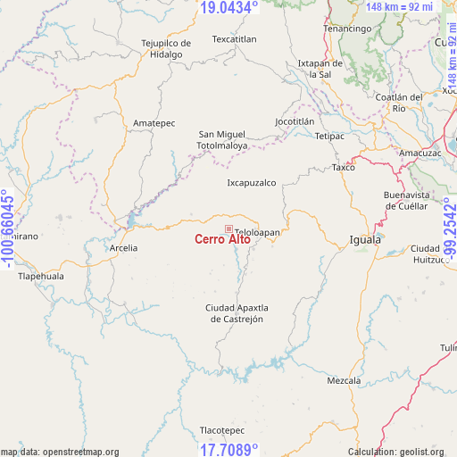
Cerro Alto GPS coordinates[2]
18° 22' 38.784" North, 99° 57' 26.352" West
| Map corner | latitude | longitude |
|---|---|---|
| Upper-left | 19.0434°, | -100.66045° |
| Center: | 18.37744°, | -99.95732° |
| Lower-right: | 17.7089°, | -99.2542° |
| Map W x H: | 148.4×148.4 km | = 92.2×92.2mi |
| max Lat: | 32.7° ⇑74.1% North |
| Cerro Alto: | 18.37744° |
| min Lat: | ⇓25.9% South 14.53588° |
| min Long | Cerro Alto | max Long |
| -117.105° | -99.95732° | -86.73105° |
| W 36.6%⇐ | ⇒63.4% E |
Elevation
Elevation of Cerro Alto is 1492 m = 4895 ft, and this is 238.3 m = 782 ft above average elevation for this country.
| Max E: |
3497 m = 11473 ft | 48.8% |
| Cerro Alto | 1492 m 4895 ft | |
| Avg. | 1253.7 m = 4113 ft | |
Min E: |
-1 m = -3 ft | 51.2% |
See also: Mexico elevation on elevation.city.
Geographical zone
Cerro Alto is located in North Torrid zone (between Equator and Tropic of Cancer). Distance of this Northern Tropic circle is 562.5 km =349.5 mi to North.| Distance of | km | miles | from Cerro Alto |
|---|---|---|---|
| North Pole | 7963.7 | 4948.4 | to North |
| Arctic Circle | 5357.8 | 3329.2 | to North |
| Tropic Cancer | 562.5 | 349.5 | to North |
| Equator | 2043.4 | 1269.7 | to South |


Nearby cities:
15 places around Cerro Alto: (largest is in red/bold)
• Acapetlahuaya
13 km =8.1 mi,  291°
291°
• Acatempan
10.3 km =6.4 mi,  130°
130°
• Acatlán de la Cruz
3.1 km =1.9 mi,  48°
48°
• Colonia el Pedregal
11.1 km =6.9 mi,  106°
106°
• El Calvario
17.9 km =11.1 mi,  123°
123°
• El Capire
5.3 km =3.3 mi,  154°
154°
• Ixcapuzalco
16.7 km =10.4 mi,  26°
26°
• Los Sauces
17.9 km =11.1 mi, 133°
• Lídice
11.9 km =7.4 mi,  326°
326°
• Oxtotitlán
21 km =13 mi,  172°
172°
• San Martín Pachivia (Pachivia)
18.2 km =11.3 mi,  79°
79°
• Tehuixtla
7.2 km =4.5 mi,  159°
159°
• Teloloapan
9.1 km =5.7 mi,  97°
97°
• Tlacaquipa
19.1 km =11.9 mi, 151°
• Totoltepec
14.3 km =8.9 mi,  218°
218°
Sources, notices
• [Note1] Compared only with cities in Mexico existing in our database
• [Src1] Map data: © OpenStreetMap contributors (CC-BY-SA)
• [Src2] Other city data from geonames.org with taken over terms of usage.
• [Src3] Geographical zone / Annual Mean Temperature by Robert A. Rohde @ Wikipedia
