La Unión geodata
La Unión (Veracruz) is a populated place; located in Mexico in America/Mexico_City (GMT-6) time zone. With population of 840 people, there are 10414 cities with bigger population in this country. Compared to other cities in Mexico, 77.5% of cities are located further ↑North; 83.2% of cities are located further ←West and 83.3% of cities have higher elevation than La Unión. Note1


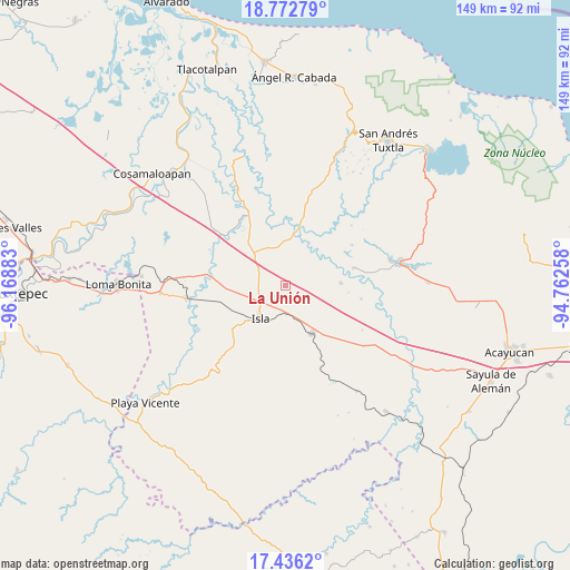
La Unión GPS coordinates[2]
18° 6' 20.772" North, 95° 27' 56.52" West
| Map corner | latitude | longitude |
|---|---|---|
| Upper-left | 18.77279°, | -96.16883° |
| Center: | 18.10577°, | -95.4657° |
| Lower-right: | 17.4362°, | -94.76258° |
| Map W x H: | 148.6×148.6 km | = 92.3×92.3mi |
| max Lat: | 32.7° ⇑77.5% North |
| La Unión: | 18.10577° |
| min Lat: | ⇓22.5% South 14.53588° |
| min Long | La Unión | max Long |
| -117.105° | -95.4657° | -86.73105° |
| W 83.2%⇐ | ⇒16.8% E |
Elevation
Elevation of La Unión is 58 m = 190 ft, and this is 1195.7 m = 3923 ft below average elevation for this country.
| Max E: |
3497 m = 11473 ft | 83.3% |
| Avg. | 1253.7 m = 4113 ft | |
| La Unión | 58 m = 190 ft | |
Min E: |
-1 m = -3 ft | 16.7% |
See also: Mexico elevation on elevation.city.
Geographical zone
La Unión is located in North Torrid zone (between Equator and Tropic of Cancer). Distance of this Northern Tropic circle is 592.7 km =368.3 mi to North.| Distance of | km | miles | from La Unión |
|---|---|---|---|
| North Pole | 7993.9 | 4967.2 | to North |
| Arctic Circle | 5388 | 3347.9 | to North |
| Tropic Cancer | 592.7 | 368.3 | to North |
| Equator | 2013.2 | 1250.9 | to South |


Nearby cities:
15 places around La Unión: (largest is in red/bold)
• Cuatotolapan Viejo
21.5 km =13.4 mi,  78°
78°
• Cujuliapan
22.6 km =14 mi,  298°
298°
• El Blanco
19.9 km =12.4 mi,  100°
100°
• El Paraíso
9.8 km =6.1 mi,  211°
211°
• El Tesoro
12.2 km =7.6 mi,  17°
17°
• El Zapotal
21.1 km =13.1 mi, 22°
• Galeras
15.9 km =9.9 mi, 15°
• Isla
11 km =6.8 mi,  217°
217°
• Juan Rodríguez Clara
14.3 km =8.9 mi,  151°
151°
• La Cañada
16.2 km =10.1 mi, 96°
• Mazoco
16.2 km =10.1 mi,  254°
254°
• Nopalapan
14.3 km =8.9 mi,  87°
87°
• Norma
20.1 km =12.5 mi,  58°
58°
• Nuevo Potrero
15.1 km =9.4 mi,  269°
269°
• Tesechoacan
20.7 km =12.9 mi,  279°
279°
Sources, notices
• [Note1] Compared only with cities in Mexico existing in our database
• [Src1] Map data: © OpenStreetMap contributors (CC-BY-SA)
• [Src2] Other city data from geonames.org with taken over terms of usage.
• [Src3] Geographical zone / Annual Mean Temperature by Robert A. Rohde @ Wikipedia
