Zapotlán del Rey geodata
Zapotlán del Rey (Jalisco) is a populated place; located in Mexico in America/Mexico_City (GMT-6) time zone. With population of 3,280 people, there are 2767 cities with bigger population in this country. Compared to other cities in Mexico, 67% of cities are located further ↓South; 85.5% of cities are located further →East and 53.6% of cities have lower elevation than Zapotlán del Rey. Note1


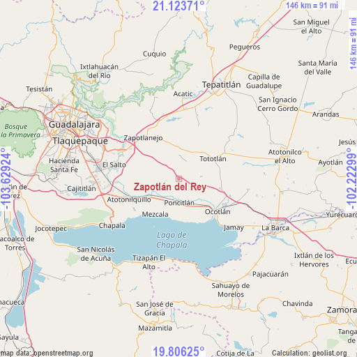
Zapotlán del Rey GPS coordinates[2]
20° 27' 59.004" North, 102° 55' 33.996" West
| Map corner | latitude | longitude |
|---|---|---|
| Upper-left | 21.12371°, | -103.62924° |
| Center: | 20.46639°, | -102.92611° |
| Lower-right: | 19.80625°, | -102.22299° |
| Map W x H: | 146.5×146.5 km | = 91×91mi |
| max Lat: | 32.7° ⇑33% North |
| Zapotlán del Rey: | 20.46639° |
| min Lat: | ⇓67% South 14.53588° |
| min Long | Zapotlán del R | max Long |
| -117.105° | -102.92611° | -86.73105° |
| W 14.5%⇐ | ⇒85.5% E |
Elevation
Elevation of Zapotlán del Rey is 1553 m = 5095 ft, and this is 299.3 m = 982 ft above average elevation for this country.
| Max E: |
3497 m = 11473 ft | 46.4% |
| Zapotlán del Rey | 1553 m 5095 ft | |
| Avg. | 1253.7 m = 4113 ft | |
Min E: |
-1 m = -3 ft | 53.6% |
See also: Mexico elevation on elevation.city.
Geographical zone
Zapotlán del Rey is located in North Torrid zone (between Equator and Tropic of Cancer). Distance of this Northern Tropic circle is 330.3 km =205.2 mi to North.| Distance of | km | miles | from Zapotlán del Rey |
|---|---|---|---|
| North Pole | 7731.4 | 4804.1 | to North |
| Arctic Circle | 5125.5 | 3184.8 | to North |
| Tropic Cancer | 330.3 | 205.2 | to North |
| Equator | 2275.6 | 1414 | to South |


Nearby cities:
15 places around Zapotlán del Rey: (largest is in red/bold)
• Ahuatlán
6.7 km =4.2 mi,  143°
143°
• Chila
4.7 km =2.9 mi,  262°
262°
• El Romereño (INFONAVIT)
9.8 km =6.1 mi,  194°
194°
• El Sauz
13 km =8.1 mi,  83°
83°
• La Colonia
4.4 km =2.7 mi, 186°
• La Noria
8.4 km =5.2 mi,  98°
98°
• La Paz
15.5 km =9.6 mi,  302°
302°
• Los Cerritos
15.7 km =9.8 mi,  85°
85°
• Otatlán
13 km =8.1 mi, 102°
• Poncitlán
9.6 km =6 mi,  179°
179°
• San Jacinto
15.6 km =9.7 mi,  240°
240°
• San Luis de Agua Caliente
14.1 km =8.8 mi,  131°
131°
• San Miguel Zapotitlán
11 km =6.8 mi,  220°
220°
• Santa Cruz el Grande
12 km =7.5 mi,  147°
147°
• Tecualtitán
11.6 km =7.2 mi,  246°
246°
Sources, notices
• [Note1] Compared only with cities in Mexico existing in our database
• [Src1] Map data: © OpenStreetMap contributors (CC-BY-SA)
• [Src2] Other city data from geonames.org with taken over terms of usage.
• [Src3] Geographical zone / Annual Mean Temperature by Robert A. Rohde @ Wikipedia
