San Cristóbal Zapotitlán geodata
San Cristóbal Zapotitlán (Jalisco) is a populated place; located in Mexico in America/Mexico_City (GMT-6) time zone. With population of 2,119 people, there are 4131 cities with bigger population in this country. Compared to other cities in Mexico, 61.9% of cities are located further ↓South; 87.6% of cities are located further →East and 52.8% of cities have lower elevation than San Cristóbal Zapotitlán. Note1
Current local time in San Cristóbal Zapotitlán:
08:59 AM, MondayDifference from your time zone: hours


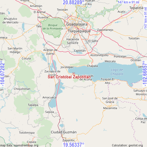
San Cristóbal Zapotitlán GPS coordinates[2]
20° 13' 28.308" North, 103° 22' 10.884" West
| Map corner | latitude | longitude |
|---|---|---|
| Upper-left | 20.88289°, | -104.07282° |
| Center: | 20.22453°, | -103.36969° |
| Lower-right: | 19.56337°, | -102.66657° |
| Map W x H: | 146.7×146.7 km | = 91.2×91.2mi |
| max Lat: | 32.7° ⇑38.1% North |
| San Cristóbal Zapotitlán: | 20.22453° |
| min Lat: | ⇓61.9% South 14.53588° |
| min Long | San Cristóbal | max Long |
| -117.105° | -103.36969° | -86.73105° |
| W 12.4%⇐ | ⇒87.6% E |
Elevation
Elevation of San Cristóbal Zapotitlán is 1538 m = 5046 ft, and this is 284.3 m = 933 ft above average elevation for this country.
| Max E: |
3497 m = 11473 ft | 47.2% |
| San Cristóbal Zapotitlán | 1538 m 5046 ft | |
| Avg. | 1253.7 m = 4113 ft | |
Min E: |
-1 m = -3 ft | 52.8% |
See also: Mexico elevation on elevation.city.
Geographical zone
San Cristóbal Zapotitlán is located in North Torrid zone (between Equator and Tropic of Cancer). Distance of this Northern Tropic circle is 357.2 km =222 mi to North.| Distance of | km | miles | from San Cristóbal Zapotitlán |
|---|---|---|---|
| North Pole | 7758.3 | 4820.8 | to North |
| Arctic Circle | 5152.4 | 3201.6 | to North |
| Tropic Cancer | 357.2 | 222 | to North |
| Equator | 2248.8 | 1397.3 | to South |


Nearby cities:
15 places around San Cristóbal Zapotitlán: (largest is in red/bold)
• Ajijic
14.8 km =9.2 mi,  53°
53°
• Cacaluta
13.5 km =8.4 mi,  241°
241°
• Citala
17.4 km =10.8 mi,  139°
139°
• Jocotepec
9.2 km =5.7 mi,  317°
317°
• Las Trojes
12.9 km =8 mi,  19°
19°
• Milpilla
10.1 km =6.3 mi,  199°
199°
• Potrerillos
12.7 km =7.9 mi,  356°
356°
• San José de Gracia
15.9 km =9.9 mi,  207°
207°
• San Juan Cosalá
7.6 km =4.7 mi, 23°
• San Luis Soyatlán
7.1 km =4.4 mi,  114°
114°
• San Pedro Tesistán
4.7 km =2.9 mi,  273°
273°
• Teocuitatlán de Corona
14.7 km =9.1 mi,  183°
183°
• Tepeguaje
17.4 km =10.8 mi, 110°
• Verdía
16.2 km =10.1 mi, 243°
• Zapotitán de Hidalgo
16 km =9.9 mi,  314°
314°
Sources, notices
• [Note1] Compared only with cities in Mexico existing in our database
• [Src1] Map data: © OpenStreetMap contributors (CC-BY-SA)
• [Src2] Other city data from geonames.org with taken over terms of usage.
• [Src3] Geographical zone / Annual Mean Temperature by Robert A. Rohde @ Wikipedia
