Felipe Neri (Cuatepec) geodata
Felipe Neri (Cuatepec) (Morelos) is a populated place; located in Mexico in America/Mexico_City (GMT-6) time zone. With population of 1,338 people, there are 6499 cities with bigger population in this country. Compared to other cities in Mexico, 64% of cities are located further ↑North; 51.2% of cities are located further ←West and 93.6% of cities have lower elevation than Felipe Neri (Cuatepec). Note1
Current local time in Felipe Neri (Cuatepec):
05:16 AM, WednesdayDifference from your time zone: hours


Felipe Neri (Cuatepec) GPS coordinates[2]
19° 2' 21.984" North, 98° 56' 36.996" West
| Map corner | latitude | longitude |
|---|---|---|
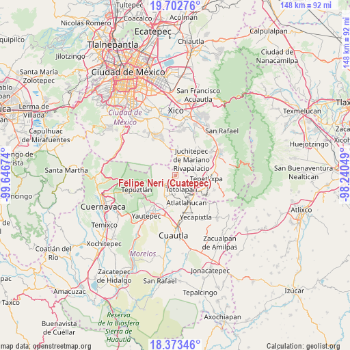
| Upper-left | 19.70276°, | -99.64674° |
| Center: | 19.03944°, | -98.94361° |
| Lower-right: | 18.37346°, | -98.24049° |
| Map W x H: | 147.8×147.8 km | = 91.8×91.8mi |
| max Lat: | 32.7° ⇑64% North |
| Felipe Neri (Cuatepec): | 19.03944° |
| min Lat: | ⇓36% South 14.53588° |
| min Long | Felipe Neri (Cu | max Long |
| -117.105° | -98.94361° | -86.73105° |
| W 51.2%⇐ | ⇒48.8% E |
Elevation
Elevation of Felipe Neri (Cuatepec) is 2555 m = 8383 ft, and this is 1301.3 m = 4269 ft above average elevation for this country.
| Max E: |
3497 m = 11473 ft | 6.4% |
| Felipe Neri (Cuatepec) | 2555 m 8383 ft | |
| Avg. | 1253.7 m = 4113 ft | |
Min E: |
-1 m = -3 ft | 93.6% |
See also: Mexico elevation on elevation.city.
Geographical zone
Felipe Neri (Cuatepec) is located in North Torrid zone (between Equator and Tropic of Cancer). Distance of this Northern Tropic circle is 488.9 km =303.8 mi to North.| Distance of | km | miles | from Felipe Neri (Cuatepec) |
|---|---|---|---|
| North Pole | 7890.1 | 4902.7 | to North |
| Arctic Circle | 5284.2 | 3283.4 | to North |
| Tropic Cancer | 488.9 | 303.8 | to North |
| Equator | 2117 | 1315.4 | to South |


Nearby cities:
15 places around Felipe Neri (Cuatepec): (largest is in red/bold)
• Ahuatlán (Asunción Ahuatlán)
5.2 km =3.2 mi,  163°
163°
• Amatlipac (San Agustín Amatlipac)
6.7 km =4.2 mi,  204°
204°
• Cuauhtempan (San Andrés Cuauhtempan)
7.2 km =4.5 mi,  182°
182°
• Cuecuecuatitla
10.9 km =6.8 mi,  105°
105°
• El Pedregal
5.6 km =3.5 mi,  228°
228°
• El Vigía
3.6 km =2.2 mi,  208°
208°
• Juchitepec
9.6 km =6 mi,  45°
45°
• La Cañada (San Sebastián)
5.9 km =3.7 mi, 205°
• Nacatongo
11.2 km =7 mi, 199°
• Nepopualco
4.5 km =2.8 mi, 178°
• San Matías Cuijingo
10.8 km =6.7 mi,  62°
62°
• Tlalnepantla
6.5 km =4 mi,  238°
238°
• Tlaltetelco (San Miguel Tlaltetelco)
11.3 km =7 mi,  148°
148°
• Tlayacapan
10.1 km =6.3 mi, 202°
• Totolapan
6.5 km =4 mi, 158°
Sources, notices
• [Note1] Compared only with cities in Mexico existing in our database
• [Src1] Map data: © OpenStreetMap contributors (CC-BY-SA)
• [Src2] Other city data from geonames.org with taken over terms of usage.
• [Src3] Geographical zone / Annual Mean Temperature by Robert A. Rohde @ Wikipedia
