Paso de Núñez (Buenavista) geodata
Paso de Núñez (Buenavista) (Michoacán) is a populated place; located in Mexico in America/Mexico_City (GMT-6) time zone. With population of 1,250 people, there are 6944 cities with bigger population in this country. Compared to other cities in Mexico, 67.1% of cities are located further ↑North; 73.1% of cities are located further →East and 64.9% of cities have higher elevation than Paso de Núñez (Buenavista). Note1
Current local time in Paso de Núñez (Buenavista):
08:29 AM, WednesdayDifference from your time zone: hours


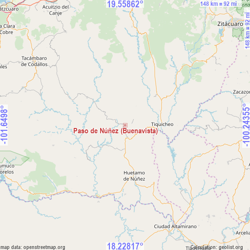
Paso de Núñez (Buenavista) GPS coordinates[2]
18° 53' 40.992" North, 100° 56' 48.012" West
| Map corner | latitude | longitude |
|---|---|---|
| Upper-left | 19.55862°, | -101.6498° |
| Center: | 18.89472°, | -100.94667° |
| Lower-right: | 18.22817°, | -100.24355° |
| Map W x H: | 147.9×147.9 km | = 91.9×91.9mi |
| max Lat: | 32.7° ⇑67.1% North |
| Paso de Núñez (Buenavista): | 18.89472° |
| min Lat: | ⇓32.9% South 14.53588° |
| min Long | Paso de Núñez | max Long |
| -117.105° | -100.94667° | -86.73105° |
| W 26.9%⇐ | ⇒73.1% E |
Elevation
Elevation of Paso de Núñez (Buenavista) is 694 m = 2277 ft, and this is 559.7 m = 1836 ft below average elevation for this country.
| Max E: |
3497 m = 11473 ft | 64.9% |
| Avg. | 1253.7 m = 4113 ft | |
| Paso de Núñez (Buenavista) | 694 m = 2277 ft | |
Min E: |
-1 m = -3 ft | 35.1% |
See also: Mexico elevation on elevation.city.
Geographical zone
Paso de Núñez (Buenavista) is located in North Torrid zone (between Equator and Tropic of Cancer). Distance of this Northern Tropic circle is 505 km =313.8 mi to North.| Distance of | km | miles | from Paso de Núñez (Buenavista) |
|---|---|---|---|
| North Pole | 7906.2 | 4912.7 | to North |
| Arctic Circle | 5300.3 | 3293.5 | to North |
| Tropic Cancer | 505 | 313.8 | to North |
| Equator | 2100.9 | 1305.4 | to South |


Nearby cities:
15 places around Paso de Núñez (Buenavista): (largest is in red/bold)
• Angao
29.5 km =18.3 mi,  145°
145°
• Arroyo Grande
36 km =22.4 mi,  131°
131°
• Carácuaro
23.3 km =14.5 mi,  306°
306°
• Ceibas de Trujillo
33.9 km =21.1 mi,  76°
76°
• Comburindio
38.5 km =23.9 mi,  183°
183°
• El Llano
28.8 km =17.9 mi,  9°
9°
• Huetamo de Núñez
30 km =18.6 mi,  169°
169°
• La Parota
26.2 km =16.3 mi, 166°
• Melchor Ocampo
36.4 km =22.6 mi,  295°
295°
• Nocupétaro
28.1 km =17.5 mi, 306°
• Purechucho
35.3 km =21.9 mi, 169°
• Purungueo
19.4 km =12.1 mi,  43°
43°
• San Lucas
37.9 km =23.5 mi, 153°
• San Nicolás Arroyo Hondo
40.8 km =25.4 mi, 167°
• Tiquicheo
22 km =13.7 mi,  87°
87°
Sources, notices
• [Note1] Compared only with cities in Mexico existing in our database
• [Src1] Map data: © OpenStreetMap contributors (CC-BY-SA)
• [Src2] Other city data from geonames.org with taken over terms of usage.
• [Src3] Geographical zone / Annual Mean Temperature by Robert A. Rohde @ Wikipedia
