Trinidad Norte geodata
Trinidad Norte (Zacatecas) is a populated place; located in Mexico in America/Mexico_City (GMT-6) time zone. With population of 511 people, there are 16451 cities with bigger population in this country. Compared to other cities in Mexico, 86.6% of cities are located further ↓South; 77.5% of cities are located further →East and 80.3% of cities have lower elevation than Trinidad Norte. Note1


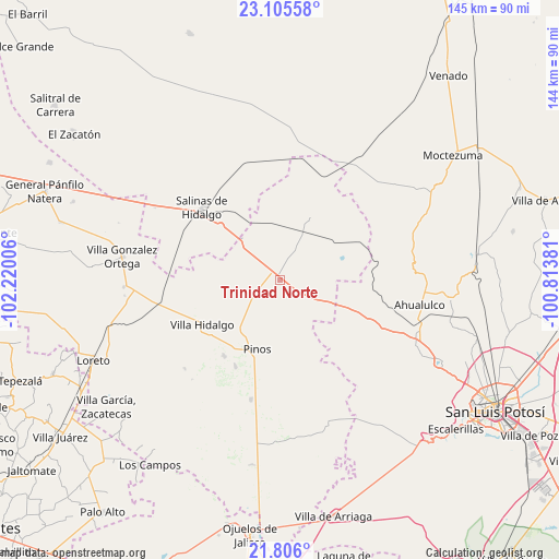
Trinidad Norte GPS coordinates[2]
22° 27' 26.316" North, 101° 31' 0.948" West
| Map corner | latitude | longitude |
|---|---|---|
| Upper-left | 23.10558°, | -102.22006° |
| Center: | 22.45731°, | -101.51693° |
| Lower-right: | 21.806°, | -100.81381° |
| Map W x H: | 144.5×144.5 km | = 89.8×89.8mi |
| max Lat: | 32.7° ⇑13.4% North |
| Trinidad Norte: | 22.45731° |
| min Lat: | ⇓86.6% South 14.53588° |
| min Long | Trinidad Norte | max Long |
| -117.105° | -101.51693° | -86.73105° |
| W 22.5%⇐ | ⇒77.5% E |
Elevation
Elevation of Trinidad Norte is 2147 m = 7044 ft, and this is 893.3 m = 2931 ft above average elevation for this country.
| Max E: |
3497 m = 11473 ft | 19.7% |
| Trinidad Norte | 2147 m 7044 ft | |
| Avg. | 1253.7 m = 4113 ft | |
Min E: |
-1 m = -3 ft | 80.3% |
See also: Mexico elevation on elevation.city.
Geographical zone
Trinidad Norte is located in North Torrid zone (between Equator and Tropic of Cancer). Distance of this Northern Tropic circle is 108.9 km =67.7 mi to North.| Distance of | km | miles | from Trinidad Norte |
|---|---|---|---|
| North Pole | 7510 | 4666.5 | to North |
| Arctic Circle | 4904.2 | 3047.3 | to North |
| Tropic Cancer | 108.9 | 67.7 | to North |
| Equator | 2497 | 1551.6 | to South |


Nearby cities:
15 places around Trinidad Norte: (largest is in red/bold)
• Ahijaderos
10.7 km =6.6 mi,  154°
154°
• Caballerías (Caballería Villa Hidalgo)
16.1 km =10 mi,  240°
240°
• El Chino
21.2 km =13.2 mi,  223°
223°
• El Tepetate
20.5 km =12.7 mi,  249°
249°
• Espíritu Santo
18.2 km =11.3 mi,  26°
26°
• Guadalupe de los Sauces
13.2 km =8.2 mi, 145°
• La Ballena
19.6 km =12.2 mi,  269°
269°
• La Pendencia
6.5 km =4 mi, 250°
• Pinos
19 km =11.8 mi,  198°
198°
• Presa de Valenzuela
20 km =12.4 mi,  232°
232°
• Saldaña
13.6 km =8.5 mi,  118°
118°
• San Andrés
9.4 km =5.8 mi, 236°
• Santa Ana
8.5 km =5.3 mi, 148°
• Santiago
6 km =3.7 mi,  92°
92°
• Tolosa
18.1 km =11.2 mi,  66°
66°
Sources, notices
• [Note1] Compared only with cities in Mexico existing in our database
• [Src1] Map data: © OpenStreetMap contributors (CC-BY-SA)
• [Src2] Other city data from geonames.org with taken over terms of usage.
• [Src3] Geographical zone / Annual Mean Temperature by Robert A. Rohde @ Wikipedia
