Kota Belud geodata
Kota Belud (Sabah) is a populated place; located in Malaysia in Asia/Kuching (GMT+8) time zone. With population of 12,825 people, there are 149 cities with bigger population in this country. Compared to other cities in Malaysia, 94.4% of cities are located further ↓South; 96.1% of cities are located further ←West and 71.3% of cities have lower elevation than Kota Belud. Note1


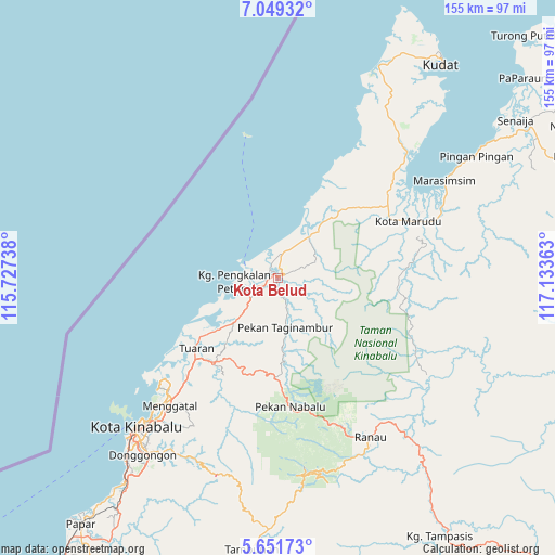
Kota Belud GPS coordinates[2]
6° 21' 3.6" North, 116° 25' 49.8" East
| Map corner | latitude | longitude |
|---|---|---|
| Upper-left | 7.04932°, | 115.72738° |
| Center: | 6.351°, | 116.4305° |
| Lower-right: | 5.65173°, | 117.13363° |
| Map W x H: | 155.4×155.4 km | = 96.6×96.6mi |
| max Lat: | 6.88732° ⇑5.6% North |
| Kota Belud: | 6.351° |
| min Lat: | ⇓94.4% South 1.24722° |
| min Long | Kota Belud | max Long |
| 99.68252° | 116.4305° | 118.61119° |
| W 96.1%⇐ | ⇒3.9% E |
Elevation
Elevation of Kota Belud is 31 m = 102 ft, and this is 13.7 m = 45 ft below average elevation for this country.
| Max E: |
1488 m = 4882 ft | 28.7% |
| Avg. | 44.7 m = 147 ft | |
| Kota Belud | 31 m = 102 ft | |
Min E: |
0 m = 0 ft | 71.3% |
See also: Malaysia elevation on elevation.city.
Geographical zone
Kota Belud is located in North Torrid zone (between Equator and Tropic of Cancer). Distance of Equator is 706.2 km =438.8 mi to South.| Distance of | km | miles | from Kota Belud |
|---|---|---|---|
| North Pole | 9300.9 | 5779.3 | to North |
| Arctic Circle | 6695 | 4160.1 | to North |
| Tropic Cancer | 1899.8 | 1180.5 | to North |
| Equator | 706.2 | 438.8 | to South |


Nearby cities:
15 places around Kota Belud: (largest is in red/bold)
• Bandar Labuan
174.5 km =108.4 mi,  227°
227°
• Beaufort
134.9 km =83.8 mi,  214°
214°
• Donggongon
61.3 km =38.1 mi,  216°
216°
• Keningau
116.6 km =72.5 mi,  194°
194°
• Kg Ramayah
63.9 km =39.7 mi, 215°
• Kinarut
72.4 km =45 mi, 215°
• Kota Kinabalu
57.6 km =35.8 mi, 223°
• Kudat
73.8 km =45.9 mi,  36°
36°
• Labuan
176.9 km =109.9 mi, 227°
• Lawas
200.6 km =124.6 mi, 214°
• Papar
88 km =54.7 mi, 218°
• Putatan
62.5 km =38.8 mi, 220°
• Ranau
51.2 km =31.8 mi,  149°
149°
• Sandakan
195 km =121.2 mi,  106°
106°
• Taman Rajawali
185.6 km =115.3 mi, 105°
Sources, notices
• [Note1] Compared only with cities in Malaysia existing in our database
• [Src1] Map data: © OpenStreetMap contributors (CC-BY-SA)
• [Src2] Other city data from geonames.org with taken over terms of usage.
• [Src3] Geographical zone / Annual Mean Temperature by Robert A. Rohde @ Wikipedia
