Wala geodata
Wala (North Province) is a seat of a second-order administrative division; located in New Caledonia in Pacific/Noumea (GMT+11) time zone. With population of 890 people, there are 28 cities with bigger population in this country. Compared to other cities in New Caledonia, 100% of cities are located further ↓South; 100% of cities are located further →East and 83.3% of cities have higher elevation than Wala. Note1


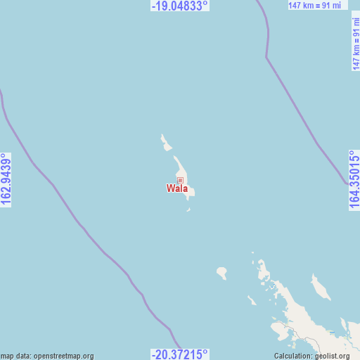
Wala GPS coordinates[2]
19° 42' 41.796" South, 163° 38' 49.272" East
| Map corner | latitude | longitude |
|---|---|---|
| Upper-left | -19.04833°, | 162.9439° |
| Center: | -19.71161°, | 163.64702° |
| Lower-right: | -20.37215°, | 164.35015° |
| Map W x H: | 147.2×147.2 km | = 91.5×91.5mi |
| max Lat: | -19.71161° ⇑0% North |
| Wala: | -19.71161° |
| min Lat: | ⇓100% South -22.66645° |
| min Long | Wala | max Long |
| 163.64702° | 163.64702° | 167.88019° |
| W 0%⇐ | ⇒100% E |
Elevation
Elevation of Wala is 8 m = 26 ft, and this is 35.3 m = 116 ft below average elevation for this country.
| Max E: |
275 m = 902 ft | 83.3% |
| Avg. | 43.3 m = 142 ft | |
| Wala | 8 m = 26 ft | |
Min E: |
1 m = 3 ft | 16.7% |
See also: New Caledonia elevation on elevation.city.
Geographical zone
Wala is located in South Torrid zone (between Equator and Tropic of Capricorn). Distance of this Southern Tropic circle is 414.2 km =257.4 mi to South.| Distance of | km | miles | from Wala |
|---|---|---|---|
| Equator | 2191.7 | 1361.9 | to North |
| Tropic Capricorn | 414.2 | 257.4 | to South |
| Antarctic Circle | 5209.4 | 3237 | to South |
| South Pole | 7815.3 | 4856.2 | to South |


Nearby cities:
15 places around Wala: (largest is in red/bold)
• Bourail
282.2 km =175.4 mi,  136°
136°
• Hienghène
172.3 km =107.1 mi,  128°
128°
• Houaïlou
269.5 km =167.5 mi, 130°
• Kaala-Gomén
132.1 km =82.1 mi, 143°
• Koné
196.5 km =122.1 mi, 139°
• Koumac
116 km =72.1 mi,  145°
145°
• Ouégoa
108.6 km =67.5 mi, 130°
• Poindimié
222.2 km =138.1 mi, 127°
• Ponérihouen
238 km =147.9 mi, 129°
• Pouembout
205 km =127.4 mi, 140°
• Poum
69.7 km =43.3 mi, 146°
• Pouébo
122.8 km =76.3 mi, 128°
• Poya
240.2 km =149.3 mi, 139°
• Touho
205.8 km =127.9 mi, 125°
• Voh
177.6 km =110.4 mi, 141°
Sources, notices
• [Note1] Compared only with cities in New Caledonia existing in our database
• [Src1] Map data: © OpenStreetMap contributors (CC-BY-SA)
• [Src2] Other city data from geonames.org with taken over terms of usage.
• [Src3] Geographical zone / Annual Mean Temperature by Robert A. Rohde @ Wikipedia
