Pouembout geodata
Pouembout (North Province) is a populated place; located in New Caledonia in Pacific/Noumea (GMT+11) time zone. With population of 1,511 people, there are 26 cities with bigger population in this country. Compared to other cities in New Caledonia, 53.3% of cities are located further ↓South; 73.3% of cities are located further →East and 70% of cities have higher elevation than Pouembout. Note1


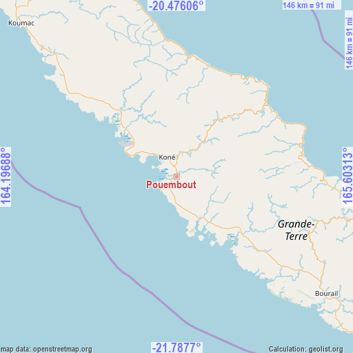
Pouembout GPS coordinates[2]
21° 7' 59.988" South, 164° 54' 0" East
| Map corner | latitude | longitude |
|---|---|---|
| Upper-left | -20.47606°, | 164.19688° |
| Center: | -21.13333°, | 164.9° |
| Lower-right: | -21.7877°, | 165.60313° |
| Map W x H: | 145.8×145.8 km | = 90.6×90.6mi |
| max Lat: | -19.71161° ⇑46.7% North |
| Pouembout: | -21.13333° |
| min Lat: | ⇓53.3% South -22.66645° |
| min Long | Pouembout | max Long |
| 163.64702° | 164.9° | 167.88019° |
| W 26.7%⇐ | ⇒73.3% E |
Elevation
Elevation of Pouembout is 11 m = 36 ft, and this is 32.3 m = 106 ft below average elevation for this country.
| Max E: |
275 m = 902 ft | 70% |
| Avg. | 43.3 m = 142 ft | |
| Pouembout | 11 m = 36 ft | |
Min E: |
1 m = 3 ft | 30% |
See also: New Caledonia elevation on elevation.city.
Geographical zone
Pouembout is located in South Torrid zone (between Equator and Tropic of Capricorn). Distance of this Southern Tropic circle is 256.1 km =159.1 mi to South.| Distance of | km | miles | from Pouembout |
|---|---|---|---|
| Equator | 2349.8 | 1460.1 | to North |
| Tropic Capricorn | 256.1 | 159.1 | to South |
| Antarctic Circle | 5051.4 | 3138.8 | to South |
| South Pole | 7657.3 | 4758 | to South |


Nearby cities:
15 places around Pouembout: (largest is in red/bold)
• Bourail
78.4 km =48.7 mi,  127°
127°
• Hienghène
50.2 km =31.2 mi,  3°
3°
• Houaïlou
76.1 km =47.3 mi,  102°
102°
• Kaala-Gomén
73.4 km =45.6 mi,  314°
314°
• Koné
8.9 km =5.5 mi,  336°
336°
• Koumac
89.9 km =55.9 mi, 314°
• Moindou
102.7 km =63.8 mi, 127°
• Ouégoa
99.7 km =62 mi,  330°
330°
• Poindimié
50.2 km =31.2 mi,  63°
63°
• Ponérihouen
52.2 km =32.4 mi,  83°
83°
• Pouébo
88.6 km =55.1 mi, 336°
• Poya
35.4 km =22 mi, 132°
• Sarraméa
113.9 km =70.8 mi,  120°
120°
• Touho
52.6 km =32.7 mi,  43°
43°
• Voh
27.8 km =17.3 mi, 311°
Sources, notices
• [Note1] Compared only with cities in New Caledonia existing in our database
• [Src1] Map data: © OpenStreetMap contributors (CC-BY-SA)
• [Src2] Other city data from geonames.org with taken over terms of usage.
• [Src3] Geographical zone / Annual Mean Temperature by Robert A. Rohde @ Wikipedia
