Kaala-Gomén geodata
Kaala-Gomén (North Province) is a populated place; located in New Caledonia in Pacific/Noumea (GMT+11) time zone. With population of 1,897 people, there are 23 cities with bigger population in this country. Compared to other cities in New Caledonia, 80% of cities are located further ↓South; 90% of cities are located further →East and 50% of cities have lower elevation than Kaala-Gomén. Note1


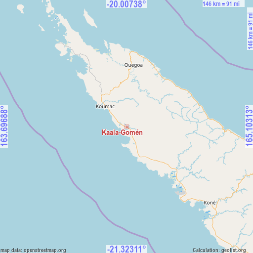
Kaala-Gomén GPS coordinates[2]
20° 40' 0.012" South, 164° 24' 0" East
| Map corner | latitude | longitude |
|---|---|---|
| Upper-left | -20.00738°, | 163.69688° |
| Center: | -20.66667°, | 164.4° |
| Lower-right: | -21.32311°, | 165.10313° |
| Map W x H: | 146.3×146.3 km | = 90.9×90.9mi |
| max Lat: | -19.71161° ⇑20% North |
| Kaala-Gomén: | -20.66667° |
| min Lat: | ⇓80% South -22.66645° |
| min Long | Kaala-Gomén | max Long |
| 163.64702° | 164.4° | 167.88019° |
| W 10%⇐ | ⇒90% E |
Elevation
Elevation of Kaala-Gomén is 12 m = 39 ft, and this is 31.3 m = 103 ft below average elevation for this country.
| Max E: |
275 m = 902 ft | 50% |
| Avg. | 43.3 m = 142 ft | |
| Kaala-Gomén | 12 m = 39 ft | |
Min E: |
1 m = 3 ft | 50% |
See also: New Caledonia elevation on elevation.city.
Geographical zone
Kaala-Gomén is located in South Torrid zone (between Equator and Tropic of Capricorn). Distance of this Southern Tropic circle is 308 km =191.4 mi to South.| Distance of | km | miles | from Kaala-Gomén |
|---|---|---|---|
| Equator | 2297.9 | 1427.8 | to North |
| Tropic Capricorn | 308 | 191.4 | to South |
| Antarctic Circle | 5103.3 | 3171 | to South |
| South Pole | 7709.1 | 4790.2 | to South |


Nearby cities:
15 places around Kaala-Gomén: (largest is in red/bold)
• Bourail
151.6 km =94.2 mi,  131°
131°
• Hienghène
55.5 km =34.5 mi,  91°
91°
• Houaïlou
143.7 km =89.3 mi,  118°
118°
• Koné
65.2 km =40.5 mi, 132°
• Koumac
16.5 km =10.3 mi,  312°
312°
• Ouégoa
35.4 km =22 mi,  5°
5°
• Poindimié
101.4 km =63 mi,  106°
106°
• Ponérihouen
113.8 km =70.7 mi, 114°
• Pouembout
73.4 km =45.6 mi, 134°
• Poum
62.6 km =38.9 mi,  320°
320°
• Pouébo
34.4 km =21.4 mi,  30°
30°
• Poya
108.8 km =67.6 mi, 134°
• Touho
89.5 km =55.6 mi,  98°
98°
• Voh
45.7 km =28.4 mi,  136°
136°
• Wala
132.1 km =82.1 mi, 323°
Sources, notices
• [Note1] Compared only with cities in New Caledonia existing in our database
• [Src1] Map data: © OpenStreetMap contributors (CC-BY-SA)
• [Src2] Other city data from geonames.org with taken over terms of usage.
• [Src3] Geographical zone / Annual Mean Temperature by Robert A. Rohde @ Wikipedia
