Ouégoa geodata
Ouégoa (North Province) is a populated place; located in New Caledonia in Pacific/Noumea (GMT+11) time zone. With population of 2,127 people, there are 22 cities with bigger population in this country. Compared to other cities in New Caledonia, 93.3% of cities are located further ↓South; 86.7% of cities are located further →East and 86.7% of cities have higher elevation than Ouégoa. Note1


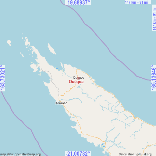
Ouégoa GPS coordinates[2]
20° 21' 0" South, 164° 25' 59.988" East
| Map corner | latitude | longitude |
|---|---|---|
| Upper-left | -19.68937°, | 163.73021° |
| Center: | -20.35°, | 164.43333° |
| Lower-right: | -21.00782°, | 165.13646° |
| Map W x H: | 146.6×146.6 km | = 91.1×91.1mi |
| max Lat: | -19.71161° ⇑6.7% North |
| Ouégoa: | -20.35° |
| min Lat: | ⇓93.3% South -22.66645° |
| min Long | Ouégoa | max Long |
| 163.64702° | 164.43333° | 167.88019° |
| W 13.3%⇐ | ⇒86.7% E |
Elevation
Elevation of Ouégoa is 5 m = 16 ft, and this is 38.3 m = 126 ft below average elevation for this country.
| Max E: |
275 m = 902 ft | 86.7% |
| Avg. | 43.3 m = 142 ft | |
| Ouégoa | 5 m = 16 ft | |
Min E: |
1 m = 3 ft | 13.3% |
See also: New Caledonia elevation on elevation.city.
Geographical zone
Ouégoa is located in South Torrid zone (between Equator and Tropic of Capricorn). Distance of this Southern Tropic circle is 343.2 km =213.3 mi to South.| Distance of | km | miles | from Ouégoa |
|---|---|---|---|
| Equator | 2262.7 | 1406 | to North |
| Tropic Capricorn | 343.2 | 213.3 | to South |
| Antarctic Circle | 5138.5 | 3192.9 | to South |
| South Pole | 7744.4 | 4812.1 | to South |


Nearby cities:
15 places around Ouégoa: (largest is in red/bold)
• Bourail
174.7 km =108.6 mi,  140°
140°
• Hienghène
63.9 km =39.7 mi,  125°
125°
• Houaïlou
160.9 km =100 mi, 130°
• Kaala-Gomén
35.4 km =22 mi,  185°
185°
• Koné
90.8 km =56.4 mi,  150°
150°
• Koumac
28.7 km =17.8 mi,  212°
212°
• Poindimié
113.9 km =70.8 mi,  124°
124°
• Ponérihouen
129.4 km =80.4 mi, 129°
• Pouembout
99.7 km =62 mi, 150°
• Poum
45.3 km =28.1 mi,  286°
286°
• Pouébo
15 km =9.3 mi,  111°
111°
• Poya
133.8 km =83.1 mi, 146°
• Touho
98.1 km =61 mi, 119°
• Voh
74 km =46 mi,  157°
157°
• Wala
108.6 km =67.5 mi,  310°
310°
Sources, notices
• [Note1] Compared only with cities in New Caledonia existing in our database
• [Src1] Map data: © OpenStreetMap contributors (CC-BY-SA)
• [Src2] Other city data from geonames.org with taken over terms of usage.
• [Src3] Geographical zone / Annual Mean Temperature by Robert A. Rohde @ Wikipedia
