Maradi geodata
Maradi is a seat of a first-order administrative division; located in Niger in Africa/Niamey (GMT+1) time zone. With population of 163,487 people, there are 2 cities with bigger population in this country. Compared to other cities in Niger, 76.7% of cities are located further ↑North; 55.8% of cities are located further ←West and 53.5% of cities have lower elevation than Maradi. Note1


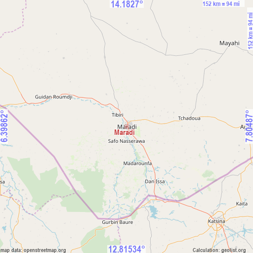
Maradi GPS coordinates[2]
13° 30' 0" North, 7° 6' 6.264" East
| Map corner | latitude | longitude |
|---|---|---|
| Upper-left | 14.1827°, | 6.39862° |
| Center: | 13.5°, | 7.10174° |
| Lower-right: | 12.81534°, | 7.80487° |
| Map W x H: | 152×152 km | = 94.4×94.4mi |
| max Lat: | 18.73694° ⇑76.7% North |
| Maradi: | 13.5° |
| min Lat: | ⇓23.3% South 11.88435° |
| min Long | Maradi | max Long |
| 0.75306° | 7.10174° | 13.10921° |
| W 55.8%⇐ | ⇒44.2% E |
Elevation
Elevation of Maradi is 360 m = 1181 ft, and this is 17.2 m = 56 ft above average elevation for this country.
| Max E: |
525 m = 1722 ft | 46.5% |
| Maradi | 360 m 1181 ft | |
| Avg. | 342.8 m = 1125 ft | |
Min E: |
177 m = 581 ft | 53.5% |
See also: Maradi elevation on elevation.city.
Geographical zone
Maradi is located in North Torrid zone (between Equator and Tropic of Cancer). Distance of this Northern Tropic circle is 1104.9 km =686.6 mi to North.| Distance of | km | miles | from Maradi |
|---|---|---|---|
| North Pole | 8506 | 5285.4 | to North |
| Arctic Circle | 5900.1 | 3666.2 | to North |
| Tropic Cancer | 1104.9 | 686.6 | to North |
| Equator | 1501.1 | 932.7 | to South |


Nearby cities:
15 places around Maradi: (largest is in red/bold)
• Aguié
73.2 km =45.5 mi,  89°
89°
• Birni N Konni
202.7 km =126 mi,  279°
279°
• Bouza
153.6 km =95.4 mi,  311°
311°
• Dakoro
118.1 km =73.4 mi,  342°
342°
• Guidan Roumdji
47.3 km =29.4 mi,  291°
291°
• Kantché
147.2 km =91.5 mi, 88°
• Keïta
199.9 km =124.2 mi, 314°
• Madaoua
138.8 km =86.2 mi,  297°
297°
• Madarounfa
22.1 km =13.7 mi,  164°
164°
• Magaria
203.5 km =126.4 mi,  105°
105°
• Matamey
148.7 km =92.4 mi, 93°
• Mayahi
79.7 km =49.5 mi,  50°
50°
• Tessaoua
99.9 km =62.1 mi,  73°
73°
• Tibiri
9 km =5.6 mi,  320°
320°
• Zinder
206.7 km =128.4 mi,  80°
80°
Sources, notices
• [Note1] Compared only with cities in Niger existing in our database
• [Src1] Map data: © OpenStreetMap contributors (CC-BY-SA)
• [Src2] Other city data from geonames.org with taken over terms of usage.
• [Src3] Geographical zone / Annual Mean Temperature by Robert A. Rohde @ Wikipedia
