Madarounfa geodata
Madarounfa (Maradi) is a seat of a second-order administrative division; located in Niger in Africa/Niamey (GMT+1) time zone. With population of 9,791 people, there are 32 cities with bigger population in this country. Compared to other cities in Niger, 83.7% of cities are located further ↑North; 58.1% of cities are located further ←West and 51.2% of cities have higher elevation than Madarounfa. Note1


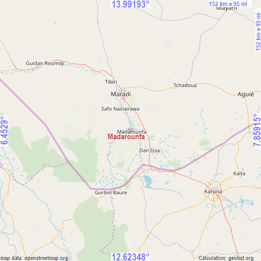
Madarounfa GPS coordinates[2]
13° 18' 31.212" North, 7° 9' 21.672" East
| Map corner | latitude | longitude |
|---|---|---|
| Upper-left | 13.99193°, | 6.4529° |
| Center: | 13.30867°, | 7.15602° |
| Lower-right: | 12.62348°, | 7.85915° |
| Map W x H: | 152.2×152.2 km | = 94.6×94.6mi |
| max Lat: | 18.73694° ⇑83.7% North |
| Madarounfa: | 13.30867° |
| min Lat: | ⇓16.3% South 11.88435° |
| min Long | Madarounfa | max Long |
| 0.75306° | 7.15602° | 13.10921° |
| W 58.1%⇐ | ⇒41.9% E |
Elevation
Elevation of Madarounfa is 356 m = 1168 ft, and this is 13.2 m = 43 ft above average elevation for this country.
| Max E: |
525 m = 1722 ft | 51.2% |
| Madarounfa | 356 m 1168 ft | |
| Avg. | 342.8 m = 1125 ft | |
Min E: |
177 m = 581 ft | 48.8% |
See also: Niger elevation on elevation.city.
Geographical zone
Madarounfa is located in North Torrid zone (between Equator and Tropic of Cancer). Distance of this Northern Tropic circle is 1126.1 km =699.7 mi to North.| Distance of | km | miles | from Madarounfa |
|---|---|---|---|
| North Pole | 8527.3 | 5298.6 | to North |
| Arctic Circle | 5921.4 | 3679.4 | to North |
| Tropic Cancer | 1126.1 | 699.7 | to North |
| Equator | 1479.8 | 919.5 | to South |


Nearby cities:
15 places around Madarounfa: (largest is in red/bold)
• Aguié
70.8 km =44 mi,  71°
71°
• Birni N Konni
213 km =132.4 mi,  284°
284°
• Bouza
172.6 km =107.2 mi,  315°
315°
• Dakoro
140.1 km =87.1 mi,  342°
342°
• Guidan Roumdji
63.1 km =39.2 mi,  307°
307°
• Kantché
143.7 km =89.3 mi,  79°
79°
• Keïta
219.2 km =136.2 mi, 317°
• Madaoua
154.6 km =96.1 mi,  303°
303°
• Magaria
193 km =119.9 mi,  100°
100°
• Maradi
22.1 km =13.7 mi, 344°
• Matamey
143.2 km =89 mi, 84°
• Mayahi
90.9 km =56.5 mi,  37°
37°
• Tessaoua
102.8 km =63.9 mi,  60°
60°
• Tibiri
30.5 km =19 mi, 337°
• Zinder
205.6 km =127.8 mi, 74°
Sources, notices
• [Note1] Compared only with cities in Niger existing in our database
• [Src1] Map data: © OpenStreetMap contributors (CC-BY-SA)
• [Src2] Other city data from geonames.org with taken over terms of usage.
• [Src3] Geographical zone / Annual Mean Temperature by Robert A. Rohde @ Wikipedia
