Madaoua geodata
Madaoua (Tahoua) is a seat of a second-order administrative division; located in Niger in Africa/Niamey (GMT+1) time zone. With population of 24,804 people, there are 13 cities with bigger population in this country. Compared to other cities in Niger, 58.1% of cities are located further ↓South; 58.1% of cities are located further →East and 58.1% of cities have higher elevation than Madaoua. Note1


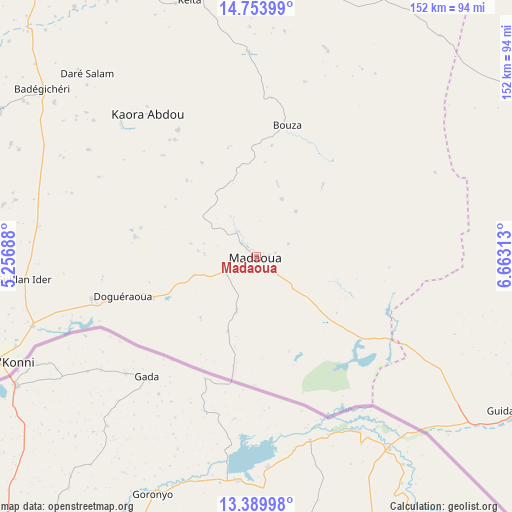
Madaoua GPS coordinates[2]
14° 4' 22.8" North, 5° 57' 36" East
| Map corner | latitude | longitude |
|---|---|---|
| Upper-left | 14.75399°, | 5.25688° |
| Center: | 14.073°, | 5.96° |
| Lower-right: | 13.38998°, | 6.66313° |
| Map W x H: | 151.7×151.7 km | = 94.3×94.3mi |
| max Lat: | 18.73694° ⇑41.9% North |
| Madaoua: | 14.073° |
| min Lat: | ⇓58.1% South 11.88435° |
| min Long | Madaoua | max Long |
| 0.75306° | 5.96° | 13.10921° |
| W 41.9%⇐ | ⇒58.1% E |
Elevation
Elevation of Madaoua is 328 m = 1076 ft, and this is 14.8 m = 49 ft below average elevation for this country.
| Max E: |
525 m = 1722 ft | 58.1% |
| Avg. | 342.8 m = 1125 ft | |
| Madaoua | 328 m = 1076 ft | |
Min E: |
177 m = 581 ft | 41.9% |
See also: Niger elevation on elevation.city.
Geographical zone
Madaoua is located in North Torrid zone (between Equator and Tropic of Cancer). Distance of this Northern Tropic circle is 1041.1 km =646.9 mi to North.| Distance of | km | miles | from Madaoua |
|---|---|---|---|
| North Pole | 8442.3 | 5245.8 | to North |
| Arctic Circle | 5836.4 | 3626.6 | to North |
| Tropic Cancer | 1041.1 | 646.9 | to North |
| Equator | 1564.8 | 972.3 | to South |


Nearby cities:
15 places around Madaoua: (largest is in red/bold)
• Abalak
157 km =97.6 mi,  12°
12°
• Aguié
206.3 km =128.2 mi,  107°
107°
• Birni N Konni
82.6 km =51.3 mi,  248°
248°
• Bouza
39.9 km =24.8 mi, 12°
• Dakoro
99.5 km =61.8 mi,  60°
60°
• Dogondoutchi
214.2 km =133.1 mi,  257°
257°
• Guidan Roumdji
91.9 km =57.1 mi,  120°
120°
• Illéla
88.4 km =54.9 mi,  299°
299°
• Keïta
78.4 km =48.7 mi,  345°
345°
• Madarounfa
154.6 km =96.1 mi, 123°
• Maradi
138.8 km =86.2 mi, 117°
• Mayahi
185.1 km =115 mi,  94°
94°
• Tahoua
117.3 km =72.9 mi,  320°
320°
• Tchintabaraden
203.5 km =126.4 mi,  355°
355°
• Tibiri
130.5 km =81.1 mi, 115°
Sources, notices
• [Note1] Compared only with cities in Niger existing in our database
• [Src1] Map data: © OpenStreetMap contributors (CC-BY-SA)
• [Src2] Other city data from geonames.org with taken over terms of usage.
• [Src3] Geographical zone / Annual Mean Temperature by Robert A. Rohde @ Wikipedia
