Kumagunnam geodata
Kumagunnam (Yobe) is a populated place; located in Nigeria in Africa/Lagos (GMT+1) time zone. With population of 16,557 people, there are 223 cities with bigger population in this country. Compared to other cities in Nigeria, 98.5% of cities are located further ↓South; 87.6% of cities are located further ←West and 60% of cities have lower elevation than Kumagunnam. Note1


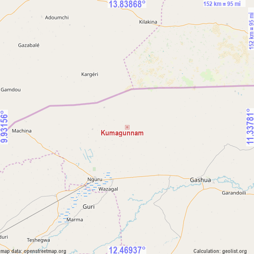
Kumagunnam GPS coordinates[2]
13° 9' 17.928" North, 10° 38' 4.848" East
| Map corner | latitude | longitude |
|---|---|---|
| Upper-left | 13.83868°, | 9.93156° |
| Center: | 13.15498°, | 10.63468° |
| Lower-right: | 12.46937°, | 11.33781° |
| Map W x H: | 152.3×152.3 km | = 94.6×94.6mi |
| max Lat: | 13.7543° ⇑1.5% North |
| Kumagunnam: | 13.15498° |
| min Lat: | ⇓98.5% South 4.31231° |
| min Long | Kumagunnam | max Long |
| 2.73333° | 10.63468° | 14.46552° |
| W 87.6%⇐ | ⇒12.4% E |
Elevation
Elevation of Kumagunnam is 346 m = 1135 ft, and this is 49.5 m = 162 ft above average elevation for this country.
| Max E: |
1599 m = 5246 ft | 40% |
| Kumagunnam | 346 m 1135 ft | |
| Avg. | 296.5 m = 973 ft | |
Min E: |
2 m = 7 ft | 60% |
See also: Nigeria elevation on elevation.city.
Geographical zone
Kumagunnam is located in North Torrid zone (between Equator and Tropic of Cancer). Distance of this Northern Tropic circle is 1143.2 km =710.4 mi to North.| Distance of | km | miles | from Kumagunnam |
|---|---|---|---|
| North Pole | 8544.4 | 5309.2 | to North |
| Arctic Circle | 5938.5 | 3690 | to North |
| Tropic Cancer | 1143.2 | 710.4 | to North |
| Equator | 1462.7 | 908.9 | to South |


Nearby cities:
15 places around Kumagunnam: (largest is in red/bold)
• Birniwa
59.2 km =36.8 mi,  226°
226°
• Gamawa
114 km =70.8 mi,  185°
185°
• Gashua
53.9 km =33.5 mi,  125°
125°
• Gorgoram
57.8 km =35.9 mi,  172°
172°
• Guri
52.9 km =32.9 mi,  206°
206°
• Gwio Kura
71 km =44.1 mi,  138°
138°
• Hadejia
101.1 km =62.8 mi,  219°
219°
• Jajimaji
34.1 km =21.2 mi,  146°
146°
• Jakusko
88.5 km =55 mi, 170°
• Katagum
101.5 km =63.1 mi,  197°
197°
• Kiri Kasamma
65.9 km =40.9 mi, 218°
• Machina
63.4 km =39.4 mi,  268°
268°
• Malam Madori
104.8 km =65.1 mi, 231°
• Mallammaduri
98.5 km =61.2 mi, 228°
• Nguru
36.5 km =22.7 mi, 212°
Sources, notices
• [Note1] Compared only with cities in Nigeria existing in our database
• [Src1] Map data: © OpenStreetMap contributors (CC-BY-SA)
• [Src2] Other city data from geonames.org with taken over terms of usage.
• [Src3] Geographical zone / Annual Mean Temperature by Robert A. Rohde @ Wikipedia
