Gwio Kura geodata
Gwio Kura (Yobe) is a populated place; located in Nigeria in Africa/Lagos (GMT+1) time zone. With population of 7,091 people, there are 415 cities with bigger population in this country. Compared to other cities in Nigeria, 93.4% of cities are located further ↓South; 89.2% of cities are located further ←West and 59.6% of cities have lower elevation than Gwio Kura. Note1


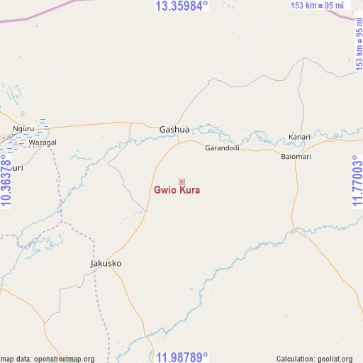
Gwio Kura GPS coordinates[2]
12° 40' 29.244" North, 11° 4' 0.84" East
| Map corner | latitude | longitude |
|---|---|---|
| Upper-left | 13.35984°, | 10.36378° |
| Center: | 12.67479°, | 11.0669° |
| Lower-right: | 11.98789°, | 11.77003° |
| Map W x H: | 152.5×152.5 km | = 94.8×94.8mi |
| max Lat: | 13.7543° ⇑6.6% North |
| Gwio Kura: | 12.67479° |
| min Lat: | ⇓93.4% South 4.31231° |
| min Long | Gwio Kura | max Long |
| 2.73333° | 11.0669° | 14.46552° |
| W 89.2%⇐ | ⇒10.8% E |
Elevation
Elevation of Gwio Kura is 342 m = 1122 ft, and this is 45.5 m = 149 ft above average elevation for this country.
| Max E: |
1599 m = 5246 ft | 40.4% |
| Gwio Kura | 342 m 1122 ft | |
| Avg. | 296.5 m = 973 ft | |
Min E: |
2 m = 7 ft | 59.6% |
See also: Nigeria elevation on elevation.city.
Geographical zone
Gwio Kura is located in North Torrid zone (between Equator and Tropic of Cancer). Distance of this Northern Tropic circle is 1196.6 km =743.5 mi to North.| Distance of | km | miles | from Gwio Kura |
|---|---|---|---|
| North Pole | 8597.8 | 5342.4 | to North |
| Arctic Circle | 5991.9 | 3723.2 | to North |
| Tropic Cancer | 1196.6 | 743.5 | to North |
| Equator | 1409.3 | 875.7 | to South |


Nearby cities:
15 places around Gwio Kura: (largest is in red/bold)
• Babban Gida
95.8 km =59.5 mi,  127°
127°
• Birniwa
91 km =56.5 mi,  278°
278°
• Dapchi
51 km =31.7 mi,  113°
113°
• Gamawa
83.2 km =51.7 mi,  223°
223°
• Gashua
22.3 km =13.9 mi,  352°
352°
• Gorgoram
39.5 km =24.5 mi,  264°
264°
• Guri
70.4 km =43.7 mi,  274°
274°
• Jajimaji
37.6 km =23.4 mi,  311°
311°
• Jakusko
46.4 km =28.8 mi, 223°
• Katagum
89.1 km =55.4 mi,  240°
240°
• Kiri Kasamma
88.1 km =54.7 mi, 271°
• Kumagunnam
71 km =44.1 mi,  318°
318°
• Lajere
87.2 km =54.2 mi,  152°
152°
• Nguru
70 km =43.5 mi,  288°
288°
• Sabon Garin Nangere
91.8 km =57 mi,  179°
179°
Sources, notices
• [Note1] Compared only with cities in Nigeria existing in our database
• [Src1] Map data: © OpenStreetMap contributors (CC-BY-SA)
• [Src2] Other city data from geonames.org with taken over terms of usage.
• [Src3] Geographical zone / Annual Mean Temperature by Robert A. Rohde @ Wikipedia
