Kebbe geodata
Kebbe (Sokoto) is a seat of a second-order administrative division; located in Nigeria in Africa/Lagos (GMT+1) time zone. In our database, there are 451 cities with bigger population. Compared to other cities in Nigeria, 85.6% of cities are located further ↓South; 84.8% of cities are located further →East and 58.5% of cities have higher elevation than Kebbe. Note1


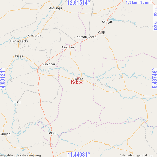
Kebbe GPS coordinates[2]
12° 7' 42.996" North, 4° 44' 3.588" East
| Map corner | latitude | longitude |
|---|---|---|
| Upper-left | 12.81514°, | 4.03121° |
| Center: | 12.12861°, | 4.73433° |
| Lower-right: | 11.44031°, | 5.43746° |
| Map W x H: | 152.9×152.9 km | = 95×95mi |
| max Lat: | 13.7543° ⇑14.4% North |
| Kebbe: | 12.12861° |
| min Lat: | ⇓85.6% South 4.31231° |
| min Long | Kebbe | max Long |
| 2.73333° | 4.73433° | 14.46552° |
| W 15.2%⇐ | ⇒84.8% E |
Elevation
Elevation of Kebbe is 221 m = 725 ft, and this is 75.5 m = 248 ft below average elevation for this country.
| Max E: |
1599 m = 5246 ft | 58.5% |
| Avg. | 296.5 m = 973 ft | |
| Kebbe | 221 m = 725 ft | |
Min E: |
2 m = 7 ft | 41.5% |
See also: Nigeria elevation on elevation.city.
Geographical zone
Kebbe is located in North Torrid zone (between Equator and Tropic of Cancer). Distance of this Northern Tropic circle is 1257.3 km =781.2 mi to North.| Distance of | km | miles | from Kebbe |
|---|---|---|---|
| North Pole | 8658.5 | 5380.1 | to North |
| Arctic Circle | 6052.6 | 3760.9 | to North |
| Tropic Cancer | 1257.3 | 781.2 | to North |
| Equator | 1348.6 | 838 | to South |


Nearby cities:
15 places around Kebbe: (largest is in red/bold)
• Aliero
33.6 km =20.9 mi,  301°
301°
• Argungu
72.2 km =44.9 mi,  341°
341°
• Birnin Kebbi
68.6 km =42.6 mi, 301°
• Bukkuyum
79.8 km =49.6 mi,  89°
89°
• Bunza
78.3 km =48.7 mi,  266°
266°
• Gulma
70.4 km =43.7 mi,  324°
324°
• Gummi
41.7 km =25.9 mi, 87°
• Gwandu
42.7 km =26.5 mi,  346°
346°
• Jega
40 km =24.9 mi,  285°
285°
• Kalgo
62.1 km =38.6 mi, 290°
• Mahuta
69.4 km =43.1 mi,  157°
157°
• Maiyama
40 km =24.9 mi,  262°
262°
• Shagari
62.2 km =38.6 mi,  26°
26°
• Tambuwal
32.3 km =20.1 mi, 342°
• Yabo
72.6 km =45.1 mi,  24°
24°
Sources, notices
• [Note1] Compared only with cities in Nigeria existing in our database
• [Src1] Map data: © OpenStreetMap contributors (CC-BY-SA)
• [Src2] Other city data from geonames.org with taken over terms of usage.
• [Src3] Geographical zone / Annual Mean Temperature by Robert A. Rohde @ Wikipedia
