Kalgo geodata
Kalgo (Kebbi) is a seat of a second-order administrative division; located in Nigeria in Africa/Lagos (GMT+1) time zone. In our database, there are 451 cities with bigger population. Compared to other cities in Nigeria, 88.4% of cities are located further ↓South; 90.2% of cities are located further →East and 60.6% of cities have higher elevation than Kalgo. Note1


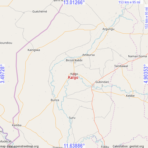
Kalgo GPS coordinates[2]
12° 19' 35.976" North, 4° 12' 1.44" East
| Map corner | latitude | longitude |
|---|---|---|
| Upper-left | 13.01266°, | 3.49728° |
| Center: | 12.32666°, | 4.2004° |
| Lower-right: | 11.63886°, | 4.90353° |
| Map W x H: | 152.8×152.8 km | = 94.9×94.9mi |
| max Lat: | 13.7543° ⇑11.6% North |
| Kalgo: | 12.32666° |
| min Lat: | ⇓88.4% South 4.31231° |
| min Long | Kalgo | max Long |
| 2.73333° | 4.2004° | 14.46552° |
| W 9.8%⇐ | ⇒90.2% E |
Elevation
Elevation of Kalgo is 204 m = 669 ft, and this is 92.5 m = 303 ft below average elevation for this country.
| Max E: |
1599 m = 5246 ft | 60.6% |
| Avg. | 296.5 m = 973 ft | |
| Kalgo | 204 m = 669 ft | |
Min E: |
2 m = 7 ft | 39.4% |
See also: Nigeria elevation on elevation.city.
Geographical zone
Kalgo is located in North Torrid zone (between Equator and Tropic of Cancer). Distance of this Northern Tropic circle is 1235.3 km =767.6 mi to North.| Distance of | km | miles | from Kalgo |
|---|---|---|---|
| North Pole | 8636.5 | 5366.5 | to North |
| Arctic Circle | 6030.6 | 3747.2 | to North |
| Tropic Cancer | 1235.3 | 767.6 | to North |
| Equator | 1370.6 | 851.7 | to South |


Nearby cities:
15 places around Kalgo: (largest is in red/bold)
• Aliero
29.7 km =18.5 mi,  98°
98°
• Argungu
58.3 km =36.2 mi,  37°
37°
• Augie
76.2 km =47.3 mi,  34°
34°
• Birnin Kebbi
14.2 km =8.8 mi,  358°
358°
• Bunza
33.3 km =20.7 mi,  217°
217°
• Dakingari
76.9 km =47.8 mi,  191°
191°
• Gulma
38.9 km =24.2 mi, 25°
• Gwandu
51.9 km =32.2 mi,  67°
67°
• Jega
22.6 km =14 mi,  120°
120°
• Kamba
79.4 km =49.3 mi,  228°
228°
• Kangiwa
48.6 km =30.2 mi,  301°
301°
• Kebbe
62.1 km =38.6 mi,  110°
110°
• Kende
90 km =55.9 mi,  175°
175°
• Maiyama
32.8 km =20.4 mi,  145°
145°
• Tambuwal
49.2 km =30.6 mi,  79°
79°
Sources, notices
• [Note1] Compared only with cities in Nigeria existing in our database
• [Src1] Map data: © OpenStreetMap contributors (CC-BY-SA)
• [Src2] Other city data from geonames.org with taken over terms of usage.
• [Src3] Geographical zone / Annual Mean Temperature by Robert A. Rohde @ Wikipedia
