Ibokun geodata
Ibokun (Osun) is a seat of a second-order administrative division; located in Nigeria in Africa/Lagos (GMT+1) time zone. In our database, there are 451 cities with bigger population. Compared to other cities in Nigeria, 56.6% of cities are located further ↑North; 84.9% of cities are located further →East and 74.4% of cities have lower elevation than Ibokun. Note1


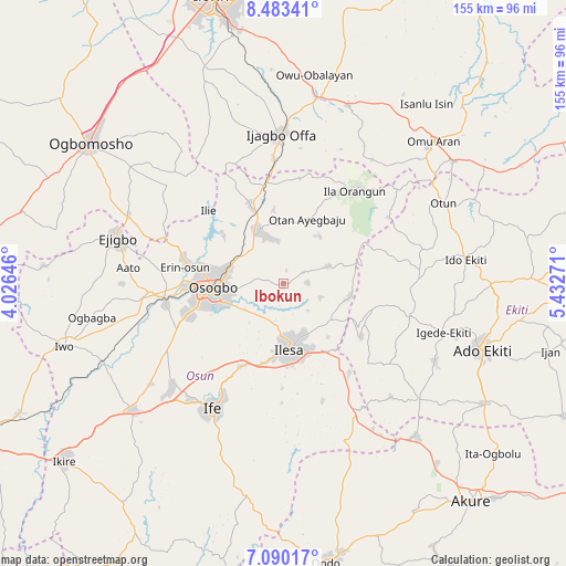
Ibokun GPS coordinates[2]
7° 47' 14.532" North, 4° 43' 46.488" East
| Map corner | latitude | longitude |
|---|---|---|
| Upper-left | 8.48341°, | 4.02646° |
| Center: | 7.78737°, | 4.72958° |
| Lower-right: | 7.09017°, | 5.43271° |
| Map W x H: | 154.9×154.9 km | = 96.3×96.3mi |
| max Lat: | 13.7543° ⇑56.6% North |
| Ibokun: | 7.78737° |
| min Lat: | ⇓43.4% South 4.31231° |
| min Long | Ibokun | max Long |
| 2.73333° | 4.72958° | 14.46552° |
| W 15.1%⇐ | ⇒84.9% E |
Elevation
Elevation of Ibokun is 425 m = 1394 ft, and this is 128.5 m = 422 ft above average elevation for this country.
| Max E: |
1599 m = 5246 ft | 25.6% |
| Ibokun | 425 m 1394 ft | |
| Avg. | 296.5 m = 973 ft | |
Min E: |
2 m = 7 ft | 74.4% |
See also: Nigeria elevation on elevation.city.
Geographical zone
Ibokun is located in North Torrid zone (between Equator and Tropic of Cancer). Distance of Equator is 865.9 km =538 mi to South.| Distance of | km | miles | from Ibokun |
|---|---|---|---|
| North Pole | 9141.2 | 5680.1 | to North |
| Arctic Circle | 6535.3 | 4060.8 | to North |
| Tropic Cancer | 1740 | 1081.2 | to North |
| Equator | 865.9 | 538 | to South |


Nearby cities:
15 places around Ibokun: (largest is in red/bold)
• Ede
32.9 km =20.4 mi,  260°
260°
• Efon-Alaaye
25.7 km =16 mi,  124°
124°
• Ifon
29.1 km =18.1 mi,  286°
286°
• Ijebu-Jesa
15.1 km =9.4 mi,  140°
140°
• Ikirun
15.5 km =9.6 mi,  333°
333°
• Ila Orangun
32 km =19.9 mi,  36°
36°
• Ilesa
17.8 km =11.1 mi,  175°
175°
• Ilobu
27.5 km =17.1 mi,  282°
282°
• Iragbiji
13.8 km =8.6 mi,  340°
340°
• Oke Mesi
20.9 km =13 mi,  81°
81°
• Okuku
26.4 km =16.4 mi,  346°
346°
• Osogbo
19.1 km =11.9 mi, 264°
• Osu
25.4 km =15.8 mi,  207°
207°
• Otan Ayegbaju
19 km =11.8 mi,  19°
19°
• Oyan
29.5 km =18.3 mi,  7°
7°
Sources, notices
• [Note1] Compared only with cities in Nigeria existing in our database
• [Src1] Map data: © OpenStreetMap contributors (CC-BY-SA)
• [Src2] Other city data from geonames.org with taken over terms of usage.
• [Src3] Geographical zone / Annual Mean Temperature by Robert A. Rohde @ Wikipedia
