Awo-Idemili geodata
Awo-Idemili (Imo) is a seat of a second-order administrative division; located in Nigeria in Africa/Lagos (GMT+1) time zone. In our database, there are 451 cities with bigger population. Compared to other cities in Nigeria, 86% of cities are located further ↑North; 58% of cities are located further →East and 68% of cities have higher elevation than Awo-Idemili. Note1


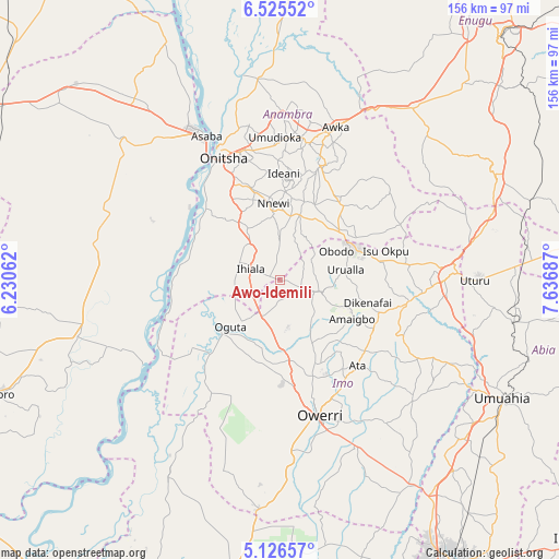
Awo-Idemili GPS coordinates[2]
5° 49' 35.328" North, 6° 56' 1.464" East
| Map corner | latitude | longitude |
|---|---|---|
| Upper-left | 6.52552°, | 6.23062° |
| Center: | 5.82648°, | 6.93374° |
| Lower-right: | 5.12657°, | 7.63687° |
| Map W x H: | 155.5×155.6 km | = 96.6×96.7mi |
| max Lat: | 13.7543° ⇑86% North |
| Awo-Idemili: | 5.82648° |
| min Lat: | ⇓14% South 4.31231° |
| min Long | Awo-Idemili | max Long |
| 2.73333° | 6.93374° | 14.46552° |
| W 42%⇐ | ⇒58% E |
Elevation
Elevation of Awo-Idemili is 158 m = 518 ft, and this is 138.5 m = 454 ft below average elevation for this country.
| Max E: |
1599 m = 5246 ft | 68% |
| Avg. | 296.5 m = 973 ft | |
| Awo-Idemili | 158 m = 518 ft | |
Min E: |
2 m = 7 ft | 32% |
See also: Nigeria elevation on elevation.city.
Geographical zone
Awo-Idemili is located in North Torrid zone (between Equator and Tropic of Cancer). Distance of Equator is 647.8 km =402.5 mi to South.| Distance of | km | miles | from Awo-Idemili |
|---|---|---|---|
| North Pole | 9359.2 | 5815.5 | to North |
| Arctic Circle | 6753.3 | 4196.3 | to North |
| Tropic Cancer | 1958.1 | 1216.7 | to North |
| Equator | 647.8 | 402.5 | to South |


Nearby cities:
15 places around Awo-Idemili: (largest is in red/bold)
• Amaigbo
22.7 km =14.1 mi,  118°
118°
• Ihiala
8.8 km =5.5 mi,  290°
290°
• Mgbidi
11.6 km =7.2 mi,  205°
205°
• Nkwerre
20.3 km =12.6 mi,  111°
111°
• Nnenasa
13.7 km =8.5 mi,  139°
139°
• Nnewi
21.6 km =13.4 mi,  355°
355°
• Oguta
18.9 km =11.7 mi,  226°
226°
• Orlu
11.7 km =7.3 mi, 106°
• Ozubulu
17.1 km =10.6 mi,  328°
328°
• Uga
20.2 km =12.6 mi,  52°
52°
• Ukpor
12.9 km =8 mi, 357°
• Umumma
7.9 km =4.9 mi,  169°
169°
• Umundugba
22.7 km =14.1 mi, 137°
• Urualla
18.5 km =11.5 mi,  80°
80°
• Uruobo-Okija
12.9 km =8 mi,  309°
309°
Sources, notices
• [Note1] Compared only with cities in Nigeria existing in our database
• [Src1] Map data: © OpenStreetMap contributors (CC-BY-SA)
• [Src2] Other city data from geonames.org with taken over terms of usage.
• [Src3] Geographical zone / Annual Mean Temperature by Robert A. Rohde @ Wikipedia
