Ihiala geodata
Ihiala (Anambra) is a seat of a second-order administrative division; located in Nigeria in Africa/Lagos (GMT+1) time zone. With population of 83,265 people, there are 107 cities with bigger population in this country. Compared to other cities in Nigeria, 85.5% of cities are located further ↑North; 59.6% of cities are located further →East and 70.3% of cities have higher elevation than Ihiala. Note1


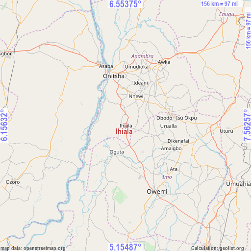
Ihiala GPS coordinates[2]
5° 51' 17.1" North, 6° 51' 33.984" East
| Map corner | latitude | longitude |
|---|---|---|
| Upper-left | 6.55375°, | 6.15632° |
| Center: | 5.85475°, | 6.85944° |
| Lower-right: | 5.15487°, | 7.56257° |
| Map W x H: | 155.5×155.5 km | = 96.6×96.6mi |
| max Lat: | 13.7543° ⇑85.5% North |
| Ihiala: | 5.85475° |
| min Lat: | ⇓14.5% South 4.31231° |
| min Long | Ihiala | max Long |
| 2.73333° | 6.85944° | 14.46552° |
| W 40.4%⇐ | ⇒59.6% E |
Elevation
Elevation of Ihiala is 146 m = 479 ft, and this is 150.5 m = 494 ft below average elevation for this country.
| Max E: |
1599 m = 5246 ft | 70.3% |
| Avg. | 296.5 m = 973 ft | |
| Ihiala | 146 m = 479 ft | |
Min E: |
2 m = 7 ft | 29.7% |
See also: Ihiala elevation on elevation.city.
Geographical zone
Ihiala is located in North Torrid zone (between Equator and Tropic of Cancer). Distance of Equator is 651 km =404.5 mi to South.| Distance of | km | miles | from Ihiala |
|---|---|---|---|
| North Pole | 9356.1 | 5813.6 | to North |
| Arctic Circle | 6750.2 | 4194.4 | to North |
| Tropic Cancer | 1954.9 | 1214.7 | to North |
| Equator | 651 | 404.5 | to South |


Nearby cities:
15 places around Ihiala: (largest is in red/bold)
• Atani
21.5 km =13.4 mi,  324°
324°
• Awo-Idemili
8.8 km =5.5 mi,  110°
110°
• Igbo-Ukwu
25.4 km =15.8 mi,  44°
44°
• Mgbidi
14 km =8.7 mi,  166°
166°
• Nnenasa
21.8 km =13.5 mi,  128°
128°
• Nnewi
19.4 km =12.1 mi,  19°
19°
• Oguta
17 km =10.6 mi,  199°
199°
• Ojoto
22.6 km =14 mi,  0°
0°
• Orlu
20.5 km =12.7 mi, 108°
• Ozubulu
11.4 km =7.1 mi,  356°
356°
• Uga
25.9 km =16.1 mi,  69°
69°
• Ukpor
12.4 km =7.7 mi, 38°
• Umumma
14.5 km =9 mi,  138°
138°
• Urualla
26.5 km =16.5 mi,  90°
90°
• Uruobo-Okija
5.4 km =3.4 mi,  340°
340°
Sources, notices
• [Note1] Compared only with cities in Nigeria existing in our database
• [Src1] Map data: © OpenStreetMap contributors (CC-BY-SA)
• [Src2] Other city data from geonames.org with taken over terms of usage.
• [Src3] Geographical zone / Annual Mean Temperature by Robert A. Rohde @ Wikipedia
