Ukpor geodata
Ukpor (Anambra) is a seat of a second-order administrative division; located in Nigeria in Africa/Lagos (GMT+1) time zone. In our database, there are 451 cities with bigger population. Compared to other cities in Nigeria, 84.4% of cities are located further ↑North; 58.1% of cities are located further →East and 73.3% of cities have higher elevation than Ukpor. Note1


Ukpor GPS coordinates[2]
5° 56' 31.596" North, 6° 55' 45.516" East
| Map corner | latitude | longitude |
|---|---|---|
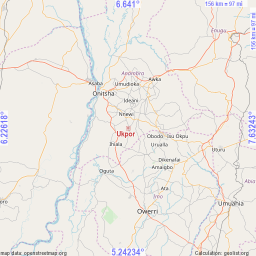
| Upper-left | 6.641°, | 6.22618° |
| Center: | 5.94211°, | 6.92931° |
| Lower-right: | 5.24234°, | 7.63243° |
| Map W x H: | 155.5×155.5 km | = 96.6×96.6mi |
| max Lat: | 13.7543° ⇑84.4% North |
| Ukpor: | 5.94211° |
| min Lat: | ⇓15.6% South 4.31231° |
| min Long | Ukpor | max Long |
| 2.73333° | 6.92931° | 14.46552° |
| W 41.9%⇐ | ⇒58.1% E |
Elevation
Elevation of Ukpor is 130 m = 427 ft, and this is 166.5 m = 546 ft below average elevation for this country.
| Max E: |
1599 m = 5246 ft | 73.3% |
| Avg. | 296.5 m = 973 ft | |
| Ukpor | 130 m = 427 ft | |
Min E: |
2 m = 7 ft | 26.7% |
See also: Nigeria elevation on elevation.city.
Geographical zone
Ukpor is located in North Torrid zone (between Equator and Tropic of Cancer). Distance of Equator is 660.7 km =410.5 mi to South.| Distance of | km | miles | from Ukpor |
|---|---|---|---|
| North Pole | 9346.4 | 5807.6 | to North |
| Arctic Circle | 6740.5 | 4188.4 | to North |
| Tropic Cancer | 1945.2 | 1208.7 | to North |
| Equator | 660.7 | 410.5 | to South |


Nearby cities:
15 places around Ukpor: (largest is in red/bold)
• Aguata
19.4 km =12.1 mi,  64°
64°
• Agulu
22.8 km =14.2 mi,  39°
39°
• Atani
21.6 km =13.4 mi,  291°
291°
• Awo-Idemili
12.9 km =8 mi,  177°
177°
• Igbo-Ukwu
13.1 km =8.1 mi,  50°
50°
• Ihiala
12.4 km =7.7 mi,  218°
218°
• Neni
20 km =12.4 mi,  31°
31°
• Nnewi
8.7 km =5.4 mi,  351°
351°
• Ojoto
15 km =9.3 mi,  329°
329°
• Orlu
20.1 km =12.5 mi,  144°
144°
• Ozubulu
8.6 km =5.3 mi,  281°
281°
• Uga
16.6 km =10.3 mi,  92°
92°
• Umumma
20.7 km =12.9 mi,  174°
174°
• Urualla
21.2 km =13.2 mi,  117°
117°
• Uruobo-Okija
10.6 km =6.6 mi,  243°
243°
Sources, notices
• [Note1] Compared only with cities in Nigeria existing in our database
• [Src1] Map data: © OpenStreetMap contributors (CC-BY-SA)
• [Src2] Other city data from geonames.org with taken over terms of usage.
• [Src3] Geographical zone / Annual Mean Temperature by Robert A. Rohde @ Wikipedia
