Auna geodata
Auna (Niger) is a populated place; located in Nigeria in Africa/Lagos (GMT+1) time zone. With population of 8,590 people, there are 367 cities with bigger population in this country. Compared to other cities in Nigeria, 65.6% of cities are located further ↓South; 85% of cities are located further →East and 61.4% of cities have higher elevation than Auna. Note1


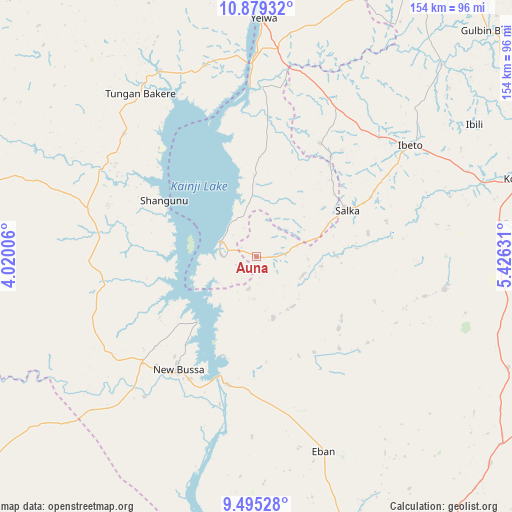
Auna GPS coordinates[2]
10° 11' 16.98" North, 4° 43' 23.448" East
| Map corner | latitude | longitude |
|---|---|---|
| Upper-left | 10.87932°, | 4.02006° |
| Center: | 10.18805°, | 4.72318° |
| Lower-right: | 9.49528°, | 5.42631° |
| Map W x H: | 153.9×153.9 km | = 95.6×95.6mi |
| max Lat: | 13.7543° ⇑34.4% North |
| Auna: | 10.18805° |
| min Lat: | ⇓65.6% South 4.31231° |
| min Long | Auna | max Long |
| 2.73333° | 4.72318° | 14.46552° |
| W 15%⇐ | ⇒85% E |
Elevation
Elevation of Auna is 198 m = 650 ft, and this is 98.5 m = 323 ft below average elevation for this country.
| Max E: |
1599 m = 5246 ft | 61.4% |
| Avg. | 296.5 m = 973 ft | |
| Auna | 198 m = 650 ft | |
Min E: |
2 m = 7 ft | 38.6% |
See also: Nigeria elevation on elevation.city.
Geographical zone
Auna is located in North Torrid zone (between Equator and Tropic of Cancer). Distance of Equator is 1132.8 km =703.9 mi to South.| Distance of | km | miles | from Auna |
|---|---|---|---|
| North Pole | 8874.3 | 5514.2 | to North |
| Arctic Circle | 6268.4 | 3895 | to North |
| Tropic Cancer | 1473.1 | 915.3 | to North |
| Equator | 1132.8 | 703.9 | to South |


Nearby cities:
15 places around Auna: (largest is in red/bold)
• Agwara
59.7 km =37.1 mi,  344°
344°
• Babana
102.9 km =63.9 mi,  285°
285°
• Bin Yauri
66.8 km =41.5 mi,  8°
8°
• Bokani
98.8 km =61.4 mi,  148°
148°
• Ibeto
56.8 km =35.3 mi,  54°
54°
• Kaiama
107.4 km =66.7 mi,  232°
232°
• Konkwesso
100.2 km =62.3 mi,  317°
317°
• Kontagora
85.2 km =52.9 mi,  73°
73°
• Mokwa
105.7 km =65.7 mi,  159°
159°
• Nasko
39.2 km =24.4 mi,  29°
29°
• New Bussa
41 km =25.5 mi,  215°
215°
• New Shagunnu
32.5 km =20.2 mi,  301°
301°
• Wara
11.8 km =7.3 mi, 292°
• Wawa
46 km =28.6 mi, 226°
• Yelwa
72 km =44.7 mi,  1°
1°
Sources, notices
• [Note1] Compared only with cities in Nigeria existing in our database
• [Src1] Map data: © OpenStreetMap contributors (CC-BY-SA)
• [Src2] Other city data from geonames.org with taken over terms of usage.
• [Src3] Geographical zone / Annual Mean Temperature by Robert A. Rohde @ Wikipedia
