Agwara geodata
Agwara (Niger) is a seat of a second-order administrative division; located in Nigeria in Africa/Lagos (GMT+1) time zone. In our database, there are 451 cities with bigger population. Compared to other cities in Nigeria, 70.4% of cities are located further ↓South; 86.6% of cities are located further →East and 59.9% of cities have higher elevation than Agwara. Note1


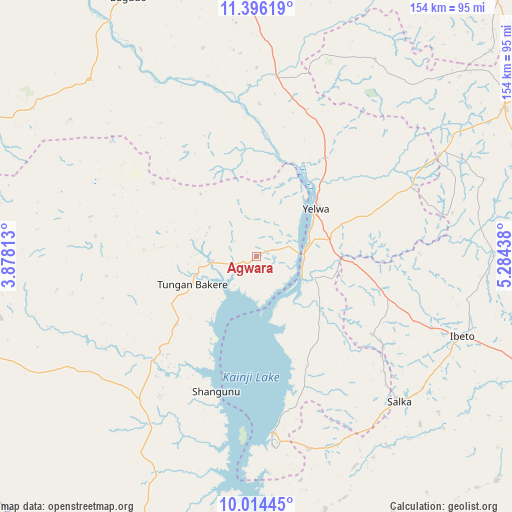
Agwara GPS coordinates[2]
10° 42' 21.996" North, 4° 34' 52.5" East
| Map corner | latitude | longitude |
|---|---|---|
| Upper-left | 11.39619°, | 3.87813° |
| Center: | 10.70611°, | 4.58125° |
| Lower-right: | 10.01445°, | 5.28438° |
| Map W x H: | 153.6×153.6 km | = 95.4×95.4mi |
| max Lat: | 13.7543° ⇑29.6% North |
| Agwara: | 10.70611° |
| min Lat: | ⇓70.4% South 4.31231° |
| min Long | Agwara | max Long |
| 2.73333° | 4.58125° | 14.46552° |
| W 13.4%⇐ | ⇒86.6% E |
Elevation
Elevation of Agwara is 208 m = 682 ft, and this is 88.5 m = 290 ft below average elevation for this country.
| Max E: |
1599 m = 5246 ft | 59.9% |
| Avg. | 296.5 m = 973 ft | |
| Agwara | 208 m = 682 ft | |
Min E: |
2 m = 7 ft | 40.1% |
See also: Nigeria elevation on elevation.city.
Geographical zone
Agwara is located in North Torrid zone (between Equator and Tropic of Cancer). Distance of Equator is 1190.4 km =739.7 mi to South.| Distance of | km | miles | from Agwara |
|---|---|---|---|
| North Pole | 8816.7 | 5478.4 | to North |
| Arctic Circle | 6210.8 | 3859.2 | to North |
| Tropic Cancer | 1415.5 | 879.6 | to North |
| Equator | 1190.4 | 739.7 | to South |


Nearby cities:
15 places around Agwara: (largest is in red/bold)
• Auna
59.7 km =37.1 mi,  164°
164°
• Babana
89.2 km =55.4 mi,  249°
249°
• Bagudo
86.7 km =53.9 mi,  333°
333°
• Besse
64.5 km =40.1 mi,  345°
345°
• Bin Yauri
26.5 km =16.5 mi,  71°
71°
• Duku
68.8 km =42.8 mi,  31°
31°
• Ibeto
66.3 km =41.2 mi,  111°
111°
• Konkwesso
55 km =34.2 mi,  286°
286°
• Nasko
41.9 km =26 mi,  124°
124°
• New Shagunnu
42.6 km =26.5 mi,  196°
196°
• Rijau
85.9 km =53.4 mi,  59°
59°
• Shanga
56.4 km =35 mi,  359°
359°
• Wara
53.3 km =33.1 mi,  175°
175°
• Wawa
91.1 km =56.6 mi,  191°
191°
• Yelwa
22.7 km =14.1 mi,  50°
50°
Sources, notices
• [Note1] Compared only with cities in Nigeria existing in our database
• [Src1] Map data: © OpenStreetMap contributors (CC-BY-SA)
• [Src2] Other city data from geonames.org with taken over terms of usage.
• [Src3] Geographical zone / Annual Mean Temperature by Robert A. Rohde @ Wikipedia
