Odeda geodata
Odeda (Ogun) is a seat of a second-order administrative division; located in Nigeria in Africa/Lagos (GMT+1) time zone. In our database, there are 451 cities with bigger population. Compared to other cities in Nigeria, 65.6% of cities are located further ↑North; 95% of cities are located further →East and 67.2% of cities have higher elevation than Odeda. Note1


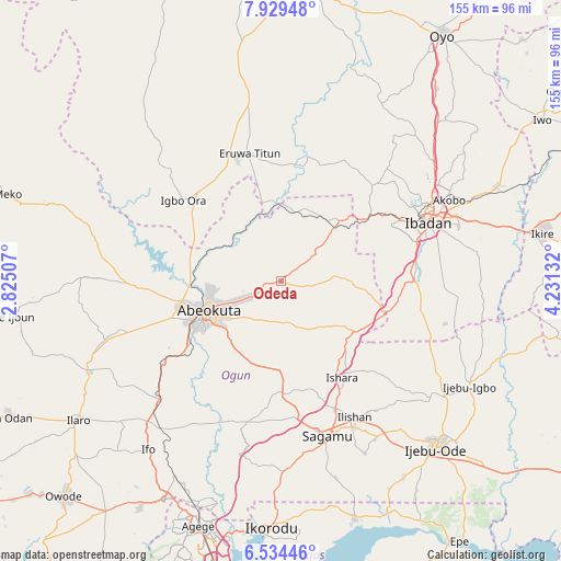
Odeda GPS coordinates[2]
7° 13' 57.036" North, 3° 31' 41.484" East
| Map corner | latitude | longitude |
|---|---|---|
| Upper-left | 7.92948°, | 2.82507° |
| Center: | 7.23251°, | 3.52819° |
| Lower-right: | 6.53446°, | 4.23132° |
| Map W x H: | 155.1×155.1 km | = 96.4×96.4mi |
| max Lat: | 13.7543° ⇑65.6% North |
| Odeda: | 7.23251° |
| min Lat: | ⇓34.4% South 4.31231° |
| min Long | Odeda | max Long |
| 2.73333° | 3.52819° | 14.46552° |
| W 5%⇐ | ⇒95% E |
Elevation
Elevation of Odeda is 161 m = 528 ft, and this is 135.5 m = 445 ft below average elevation for this country.
| Max E: |
1599 m = 5246 ft | 67.2% |
| Avg. | 296.5 m = 973 ft | |
| Odeda | 161 m = 528 ft | |
Min E: |
2 m = 7 ft | 32.8% |
See also: Nigeria elevation on elevation.city.
Geographical zone
Odeda is located in North Torrid zone (between Equator and Tropic of Cancer). Distance of Equator is 804.2 km =499.7 mi to South.| Distance of | km | miles | from Odeda |
|---|---|---|---|
| North Pole | 9202.9 | 5718.4 | to North |
| Arctic Circle | 6597 | 4099.2 | to North |
| Tropic Cancer | 1801.7 | 1119.5 | to North |
| Equator | 804.2 | 499.7 | to South |


Nearby cities:
15 places around Odeda: (largest is in red/bold)
• Abeokuta
21.9 km =13.6 mi,  247°
247°
• Ayete
48.2 km =30 mi,  315°
315°
• Eruwa
35.6 km =22.1 mi,  340°
340°
• Ibadan
44.7 km =27.8 mi,  68°
68°
• Idi-Ayunre
36.8 km =22.9 mi,  89°
89°
• Ido
36.6 km =22.7 mi,  43°
43°
• Igbo-Ora
34.7 km =21.6 mi,  310°
310°
• Ikenne
45.7 km =28.4 mi,  153°
153°
• Iperu
38.9 km =24.2 mi,  157°
157°
• Isara
31.5 km =19.6 mi, 147°
• Itori
47.6 km =29.6 mi,  225°
225°
• Odogbolu
50.7 km =31.5 mi, 149°
• Orita Eruwa
36.8 km =22.9 mi, 343°
• Owode
31.7 km =19.7 mi,  184°
184°
• Shagamu
44.6 km =27.7 mi, 163°
Sources, notices
• [Note1] Compared only with cities in Nigeria existing in our database
• [Src1] Map data: © OpenStreetMap contributors (CC-BY-SA)
• [Src2] Other city data from geonames.org with taken over terms of usage.
• [Src3] Geographical zone / Annual Mean Temperature by Robert A. Rohde @ Wikipedia
