El Tortuguero geodata
El Tortuguero (South Caribbean Coast) is a seat of a second-order administrative division; located in Nicaragua in America/Managua (GMT-6) time zone. With population of 1,292 people, there are 121 cities with bigger population in this country. Compared to other cities in Nicaragua, 59.3% of cities are located further ↓South; 94% of cities are located further ←West and 92.8% of cities have higher elevation than El Tortuguero. Note1


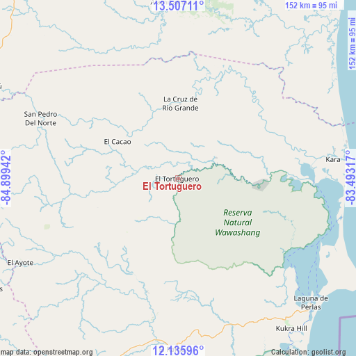
El Tortuguero GPS coordinates[2]
12° 49' 20.892" North, 84° 11' 46.644" West
| Map corner | latitude | longitude |
|---|---|---|
| Upper-left | 13.50711°, | -84.89942° |
| Center: | 12.82247°, | -84.19629° |
| Lower-right: | 12.13596°, | -83.49317° |
| Map W x H: | 152.5×152.5 km | = 94.8×94.8mi |
| max Lat: | 14.74189° ⇑40.7% North |
| El Tortuguero: | 12.82247° |
| min Lat: | ⇓59.3% South 10.94684° |
| min Long | El Tortuguero | max Long |
| -87.4516° | -84.19629° | -83.06145° |
| W 94%⇐ | ⇒6% E |
Elevation
Elevation of El Tortuguero is 15 m = 49 ft, and this is 322.2 m = 1057 ft below average elevation for this country.
| Max E: |
1288 m = 4226 ft | 92.8% |
| Avg. | 337.2 m = 1106 ft | |
| El Tortuguero | 15 m = 49 ft | |
Min E: |
1 m = 3 ft | 7.2% |
See also: Nicaragua elevation on elevation.city.
Geographical zone
El Tortuguero is located in North Torrid zone (between Equator and Tropic of Cancer). Distance of this Northern Tropic circle is 1180.2 km =733.3 mi to North.| Distance of | km | miles | from El Tortuguero |
|---|---|---|---|
| North Pole | 8581.3 | 5332.2 | to North |
| Arctic Circle | 5975.4 | 3712.9 | to North |
| Tropic Cancer | 1180.2 | 733.3 | to North |
| Equator | 1425.7 | 885.9 | to South |


Nearby cities:
15 places around El Tortuguero: (largest is in red/bold)
• Bluefields
101.5 km =63.1 mi,  152°
152°
• Bocana de Paiwas
100.5 km =62.4 mi,  267°
267°
• El Ayote
76.1 km =47.3 mi,  241°
241°
• El Coral
111.9 km =69.5 mi,  206°
206°
• El Rama
73.7 km =45.8 mi,  181°
181°
• Karawala
68.2 km =42.4 mi,  79°
79°
• Kukrahill
81.1 km =50.4 mi,  142°
142°
• La Cruz de Río Grande
32.3 km =20.1 mi,  2°
2°
• Laguna de Perlas
78 km =48.5 mi,  133°
133°
• Muelle de los Bueyes
91.4 km =56.8 mi,  203°
203°
• Mulukukú
91.1 km =56.6 mi,  295°
295°
• Prinzapolka
94.4 km =58.7 mi,  46°
46°
• Río Blanco
112 km =69.6 mi,  276°
276°
• Santo Domingo
114.5 km =71.1 mi, 237°
• Siuna
119.2 km =74.1 mi,  328°
328°
Sources, notices
• [Note1] Compared only with cities in Nicaragua existing in our database
• [Src1] Map data: © OpenStreetMap contributors (CC-BY-SA)
• [Src2] Other city data from geonames.org with taken over terms of usage.
• [Src3] Geographical zone / Annual Mean Temperature by Robert A. Rohde @ Wikipedia
