Zaanstad geodata
Zaanstad (North Holland) is a populated place; located in Netherlands in Europe/Amsterdam (GMT+2) time zone. With population of 140,085 people, there are 13 cities with bigger population in this country. Compared to other cities in Netherlands, 70.2% of cities are located further ↓South; 79% of cities are located further →East and 74.9% of cities have higher elevation than Zaanstad. Note1


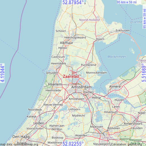
Zaanstad GPS coordinates[2]
52° 27' 11.268" North, 4° 48' 48.816" East
| Map corner | latitude | longitude |
|---|---|---|
| Upper-left | 52.87954°, | 4.11044° |
| Center: | 52.45313°, | 4.81356° |
| Lower-right: | 52.02255°, | 5.51669° |
| Map W x H: | 95.3×95.3 km | = 59.2×59.2mi |
| max Lat: | 53.48025° ⇑29.8% North |
| Zaanstad: | 52.45313° |
| min Lat: | ⇓70.2% South 50.76917° |
| min Long | Zaanstad | max Long |
| 3.38611° | 4.81356° | 7.16528° |
| W 21%⇐ | ⇒79% E |
Elevation
Elevation of Zaanstad is 2 m = 7 ft, and this is 13 m = 43 ft below average elevation for this country.
| Max E: |
203 m = 666 ft | 74.9% |
| Avg. | 15 m = 49 ft | |
| Zaanstad | 2 m = 7 ft | |
Min E: |
-6 m = -20 ft | 25.1% |
See also: Zaanstad elevation on elevation.city.
Geographical zone
Zaanstad is located in North temperate zone (between Tropic of Cancer and the Arctic Circle). Distance of this North polar circle is 1568.9 km =974.9 mi to North.| Distance of | km | miles | from Zaanstad |
|---|---|---|---|
| North Pole | 4174.8 | 2594.1 | to North |
| Arctic Circle | 1568.9 | 974.9 | to North |
| Tropic Cancer | 3226.3 | 2004.7 | to South |
| Equator | 5832.2 | 3624 | to South |


Nearby cities:
15 places around Zaanstad: (largest is in red/bold)
• Amsterdam
10.2 km =6.3 mi,  149°
149°
• Beverwijk
11.1 km =6.9 mi,  287°
287°
• Den Ilp
6.3 km =3.9 mi,  88°
88°
• Halfweg
8.8 km =5.5 mi,  207°
207°
• Halfweg
11.1 km =6.9 mi,  44°
44°
• Hofgeest
10.6 km =6.6 mi,  264°
264°
• Ilpendam
9.3 km =5.8 mi,  83°
83°
• Kadoelen
7.4 km =4.6 mi,  122°
122°
• Landsmeer
7.3 km =4.5 mi,  109°
109°
• Langeheit
5.7 km =3.5 mi,  319°
319°
• Oostknollendam
7.3 km =4.5 mi,  348°
348°
• Uitgeest
11 km =6.8 mi, 320°
• Velsen-Zuid
11.1 km =6.9 mi,  273°
273°
• Zaandam
1.8 km =1.1 mi, 151°
• Zaandijk
2.5 km =1.6 mi, 349°
Sources, notices
• [Note1] Compared only with cities in Netherlands existing in our database
• [Src1] Map data: © OpenStreetMap contributors (CC-BY-SA)
• [Src2] Other city data from geonames.org with taken over terms of usage.
• [Src3] Geographical zone / Annual Mean Temperature by Robert A. Rohde @ Wikipedia
