Anjum geodata
Anjum (Friesland) is a populated place; located in Netherlands in Europe/Amsterdam (GMT+2) time zone. With population of 880 people, there are 1476 cities with bigger population in this country. Compared to other cities in Netherlands, 99.2% of cities are located further ↓South; 80.5% of cities are located further ←West and 83.9% of cities have higher elevation than Anjum. Note1


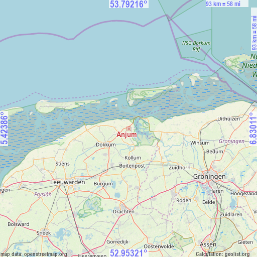
Anjum GPS coordinates[2]
53° 22' 29.1" North, 6° 7' 37.128" East
| Map corner | latitude | longitude |
|---|---|---|
| Upper-left | 53.79216°, | 5.42386° |
| Center: | 53.37475°, | 6.12698° |
| Lower-right: | 52.95321°, | 6.83011° |
| Map W x H: | 93.3×93.3 km | = 58×58mi |
| max Lat: | 53.48025° ⇑0.8% North |
| Anjum: | 53.37475° |
| min Lat: | ⇓99.2% South 50.76917° |
| min Long | Anjum | max Long |
| 3.38611° | 6.12698° | 7.16528° |
| W 80.5%⇐ | ⇒19.5% E |
Elevation
Elevation of Anjum is 1 m = 3 ft, and this is 14 m = 46 ft below average elevation for this country.
| Max E: |
203 m = 666 ft | 83.9% |
| Avg. | 15 m = 49 ft | |
| Anjum | 1 m = 3 ft | |
Min E: |
-6 m = -20 ft | 16.1% |
See also: Netherlands elevation on elevation.city.
Geographical zone
Anjum is located in North temperate zone (between Tropic of Cancer and the Arctic Circle). Distance of this North polar circle is 1466.5 km =911.2 mi to North.| Distance of | km | miles | from Anjum |
|---|---|---|---|
| North Pole | 4072.3 | 2530.4 | to North |
| Arctic Circle | 1466.5 | 911.2 | to North |
| Tropic Cancer | 3328.8 | 2068.4 | to South |
| Equator | 5934.7 | 3687.7 | to South |


Nearby cities:
15 places around Anjum: (largest is in red/bold)
• Buitenpost
13.7 km =8.5 mi,  175°
175°
• Burum
13.2 km =8.2 mi,  148°
148°
• Damwâld
12.7 km =7.9 mi,  222°
222°
• Dokkum
10.4 km =6.5 mi,  235°
235°
• Driezum
10.3 km =6.4 mi,  211°
211°
• Ee
5.3 km =3.3 mi,  199°
199°
• Kollum
11 km =6.8 mi,  170°
170°
• Kollumerzwaag
13 km =8.1 mi, 195°
• Metslawier
4.3 km =2.7 mi,  247°
247°
• Oosternijkerk
4.9 km =3 mi,  274°
274°
• Oudwoude
10.4 km =6.5 mi, 184°
• Schiermonnikoog
11.8 km =7.3 mi,  8°
8°
• Ternaard
10.8 km =6.7 mi, 274°
• Wâlterswâld
10.4 km =6.5 mi, 216°
• Zoutkamp
12.4 km =7.7 mi,  108°
108°
Sources, notices
• [Note1] Compared only with cities in Netherlands existing in our database
• [Src1] Map data: © OpenStreetMap contributors (CC-BY-SA)
• [Src2] Other city data from geonames.org with taken over terms of usage.
• [Src3] Geographical zone / Annual Mean Temperature by Robert A. Rohde @ Wikipedia
