Dale geodata
Dale (Oppland) is a populated locality; located in Norway in Europe/Oslo (GMT+2) time zone. With population of 773 people, there are 361 cities with bigger population in this country. Compared to other cities in Norway, 62.3% of cities are located further ↓South; 56.3% of cities are located further →East and 97.3% of cities have lower elevation than Dale. Note1


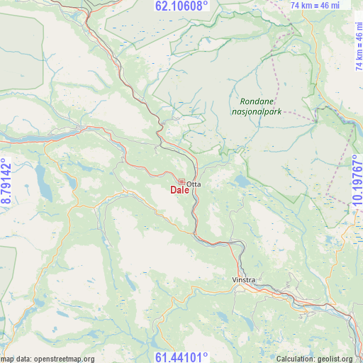
Dale GPS coordinates[2]
61° 46' 31.224" North, 9° 29' 40.344" East
| Map corner | latitude | longitude |
|---|---|---|
| Upper-left | 62.10608°, | 8.79142° |
| Center: | 61.77534°, | 9.49454° |
| Lower-right: | 61.44101°, | 10.19767° |
| Map W x H: | 73.9×73.9 km | = 45.9×45.9mi |
| max Lat: | 71.04137° ⇑37.7% North |
| Dale: | 61.77534° |
| min Lat: | ⇓62.3% South 58.0274° |
| min Long | Dale | max Long |
| 4.71485° | 9.49454° | 31.11066° |
| W 43.7%⇐ | ⇒56.3% E |
Elevation
Elevation of Dale is 526 m = 1726 ft, and this is 421.8 m = 1384 ft above average elevation for this country.
| Max E: |
897 m = 2943 ft | 2.7% |
| Dale | 526 m 1726 ft | |
| Avg. | 104.2 m = 342 ft | |
Min E: |
1 m = 3 ft | 97.3% |
See also: Norway elevation on elevation.city.
Geographical zone
Dale is located in North temperate zone (between Tropic of Cancer and the Arctic Circle). Distance of this North polar circle is 532.4 km =330.8 mi to North.| Distance of | km | miles | from Dale |
|---|---|---|---|
| North Pole | 3138.3 | 1950 | to North |
| Arctic Circle | 532.4 | 330.8 | to North |
| Tropic Cancer | 4262.9 | 2648.8 | to South |
| Equator | 6868.8 | 4268.1 | to South |


Nearby cities:
15 places around Dale: (largest is in red/bold)
• Alvdal
70 km =43.5 mi,  58°
58°
• Bismo
65.6 km =40.8 mi,  280°
280°
• Bismoen
65.6 km =40.8 mi, 280°
• Dombås
38.5 km =23.9 mi,  330°
330°
• Dovre
26.7 km =16.6 mi, 332°
• Folldal
47.6 km =29.6 mi,  33°
33°
• Fossbergom
49.1 km =30.5 mi, 278°
• Hundorp
34 km =21.1 mi,  136°
136°
• Kvam
15.9 km =9.9 mi, 140°
• Lesja
50.4 km =31.3 mi,  319°
319°
• Otta
2.2 km =1.4 mi,  102°
102°
• Ringebu
43.6 km =27.1 mi,  128°
128°
• Tretten
66.7 km =41.4 mi, 140°
• Vinstra
24.2 km =15 mi,  145°
145°
• Vågåmo
23.6 km =14.7 mi,  297°
297°
Sources, notices
• [Note1] Compared only with cities in Norway existing in our database
• [Src1] Map data: © OpenStreetMap contributors (CC-BY-SA)
• [Src2] Other city data from geonames.org with taken over terms of usage.
• [Src3] Geographical zone / Annual Mean Temperature by Robert A. Rohde @ Wikipedia
