Dovre geodata
Dovre (Oppland) is a seat of a second-order administrative division; located in Norway in Europe/Oslo (GMT+2) time zone. With population of 439 people, there are 469 cities with bigger population in this country. Compared to other cities in Norway, 64.1% of cities are located further ↓South; 57.8% of cities are located further →East and 97.5% of cities have lower elevation than Dovre. Note1


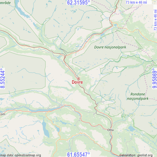
Dovre GPS coordinates[2]
61° 59' 15" North, 9° 15' 20.016" East
| Map corner | latitude | longitude |
|---|---|---|
| Upper-left | 62.31595°, | 8.55244° |
| Center: | 61.9875°, | 9.25556° |
| Lower-right: | 61.65547°, | 9.95869° |
| Map W x H: | 73.4×73.4 km | = 45.6×45.6mi |
| max Lat: | 71.04137° ⇑35.9% North |
| Dovre: | 61.9875° |
| min Lat: | ⇓64.1% South 58.0274° |
| min Long | Dovre | max Long |
| 4.71485° | 9.25556° | 31.11066° |
| W 42.2%⇐ | ⇒57.8% E |
Elevation
Elevation of Dovre is 540 m = 1772 ft, and this is 435.8 m = 1430 ft above average elevation for this country.
| Max E: |
897 m = 2943 ft | 2.5% |
| Dovre | 540 m 1772 ft | |
| Avg. | 104.2 m = 342 ft | |
Min E: |
1 m = 3 ft | 97.5% |
See also: Norway elevation on elevation.city.
Geographical zone
Dovre is located in North temperate zone (between Tropic of Cancer and the Arctic Circle). Distance of this North polar circle is 508.8 km =316.2 mi to North.| Distance of | km | miles | from Dovre |
|---|---|---|---|
| North Pole | 3114.7 | 1935.4 | to North |
| Arctic Circle | 508.8 | 316.2 | to North |
| Tropic Cancer | 4286.4 | 2663.4 | to South |
| Equator | 6892.4 | 4282.7 | to South |


Nearby cities:
15 places around Dovre: (largest is in red/bold)
• Alvdal
72.9 km =45.3 mi,  79°
79°
• Bismo
53 km =32.9 mi,  257°
257°
• Bismoen
53 km =32.9 mi, 257°
• Dale
26.7 km =16.6 mi,  152°
152°
• Dombås
11.8 km =7.3 mi,  325°
325°
• Folldal
41.8 km =26 mi,  67°
67°
• Fossbergom
39.6 km =24.6 mi,  245°
245°
• Hundorp
60.1 km =37.3 mi,  143°
143°
• Kvam
42.4 km =26.3 mi, 147°
• Lesja
25.1 km =15.6 mi,  305°
305°
• Oppdal
71.1 km =44.2 mi,  18°
18°
• Otta
28.2 km =17.5 mi, 148°
• Ringebu
68.9 km =42.8 mi, 137°
• Vinstra
50.8 km =31.6 mi, 149°
• Vågåmo
15 km =9.3 mi,  213°
213°
Sources, notices
• [Note1] Compared only with cities in Norway existing in our database
• [Src1] Map data: © OpenStreetMap contributors (CC-BY-SA)
• [Src2] Other city data from geonames.org with taken over terms of usage.
• [Src3] Geographical zone / Annual Mean Temperature by Robert A. Rohde @ Wikipedia
